Area Overview for B75 5DJ
Photos of B75 5DJ
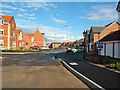

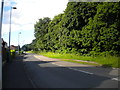
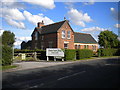
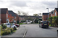
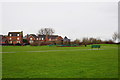
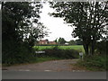
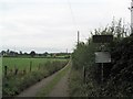
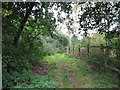
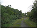
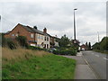
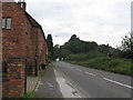
26 photos from this area
Area Information
Key information about the B75 5DJ including its size, population, and administrative classification.
- Area Type
- Postcode
- Area Size
- 1.2 hectares
- Population
- 2795
- Population Density
- 852 people/km²
House Prices in B75 5DJ
34
Properties
£335,675
Average Sold Price
£188,000
Lowest Price
£725,000
Highest Price
Showing 34 properties
| Address | Type | Beds | Baths | Last Sale Price | Last Sale Date | |
|---|---|---|---|---|---|---|
| 20 Ramblers Way, Sutton Coldfield, B75 5DJ | Detached | 5 | - | £725,000 | Sep 2025 | |
| 5 Ramblers Way, Sutton Coldfield, B75 5DJ | Detached | 4 | 2 | £542,500 | Nov 2024 | |
| 27 Ramblers Way, Sutton Coldfield, B75 5DJ | Detached | 3 | 2 | £423,500 | Feb 2024 | |
| 23 Ramblers Way, Sutton Coldfield, B75 5DJ | Detached | 4 | 2 | £558,000 | May 2023 | |
| 44 Ramblers Way, Sutton Coldfield, B75 5DJ | house | - | - | £277,000 | Mar 2021 | |
| 43 Ramblers Way, Sutton Coldfield, B75 5DJ | Semi-detached | 3 | 1 | £272,000 | Jan 2021 | |
| 19 Ramblers Way, Sutton Coldfield, B75 5DJ | Detached | 4 | 2 | £405,000 | Nov 2019 | |
| 50 Ramblers Way, Sutton Coldfield, B75 5DJ | Terraced | 4 | 2 | £270,000 | Jul 2018 | |
| 41 Ramblers Way, Sutton Coldfield, B75 5DJ | house | - | - | £253,500 | Jul 2017 | |
| 35 Ramblers Way, Sutton Coldfield, B75 5DJ | Terraced | 3 | 1 | £215,000 | Sep 2014 |
Page 1 of 4
Energy Efficiency in B75 5DJ
Amenities
Schools
| Rank | School | Type | Entry gender | Ages |
|---|
Explore more schools in this area
Go to Schools tabDemographics
Household Size
Family (3-5 people)
most common
Accommodation Type
Houses
most common
Tenure
81
majority
Ethnic Group
White
most common
Religion
N/A
most common
Household Composition
N/A
most common
Age
47
median
Adults (30-64 years)
most common
Household Deprivation
N/A
with no deprivation
NS-SEC
49
in Lower managerial occupations
Explore more demographic insights in this area
Go to Demographics tabPlanning
Planning Constraints
- Flood RiskPremium
- Ramsar Wetland SitesPremium
- Area of Outstanding Natural BeautyPremium
- Protected Nature ReservePremium
- Protected WoodlandPremium