Area Overview for B74 4RD
Photos of B74 4RD
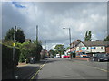
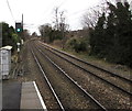


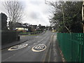
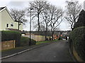
10 photos from this area
Area Information
Key information about the B74 4RD including its size, population, and administrative classification.
- Area Type
- Postcode
- Area Size
- 1.4 hectares
- Population
- 1612
- Population Density
- 4494 people/km²
House Prices in B74 4RD
18
Properties
£434,792
Average Sold Price
£220,000
Lowest Price
£700,000
Highest Price
Showing 18 properties
| Address | Type | Beds | Baths | Last Sale Price | Last Sale Date | |
|---|---|---|---|---|---|---|
| 160 Walsall Road, Sutton Four Oaks, Sutton Coldfield, B74 4RD | Detached | 5 | 3 | £630,000 | Jan 2022 | |
| 140 Walsall Road, Sutton Four Oaks, Sutton Coldfield, B74 4RD | house | - | - | £700,000 | Nov 2021 | |
| 164 Walsall Road, Sutton Four Oaks, Sutton Coldfield, B74 4RD | house | - | - | £490,000 | Mar 2016 | |
| 142 Walsall Road, Sutton Four Oaks, Sutton Coldfield, B74 4RD | house | - | - | £395,000 | Jun 2014 | |
| 138 Walsall Road, Sutton Four Oaks, Sutton Coldfield, B74 4RD | Detached | - | - | £376,000 | May 2014 | |
| 152 Walsall Road, Sutton Four Oaks, Sutton Coldfield, B74 4RD | house | - | - | £380,000 | Oct 2013 | |
| 156 Walsall Road, Sutton Four Oaks, Sutton Coldfield, B74 4RD | Detached | 4 | - | £415,000 | Apr 2013 | |
| 154 Walsall Road, Sutton Four Oaks, Sutton Coldfield, B74 4RD | house | 4 | - | £406,500 | Jan 2012 | |
| 136 Walsall Road, Sutton Four Oaks, Sutton Coldfield, B74 4RD | house | - | - | £400,000 | Nov 2008 | |
| 134 Walsall Road, Sutton Four Oaks, Sutton Coldfield, B74 4RD | Detached | - | - | £420,000 | Aug 2006 |
Page 1 of 2
Energy Efficiency in B74 4RD
Amenities
Schools
| Rank | School | Type | Entry gender | Ages |
|---|
Explore more schools in this area
Go to Schools tabDemographics
Household Size
Family (3-5 people)
most common
Accommodation Type
Houses
most common
Tenure
75
majority
Ethnic Group
White
most common
Religion
N/A
most common
Household Composition
N/A
most common
Age
47
median
Adults (30-64 years)
most common
Household Deprivation
N/A
with no deprivation
NS-SEC
46
in Lower managerial occupations
Explore more demographic insights in this area
Go to Demographics tabPlanning
Planning Constraints
- Flood RiskPremium
- Ramsar Wetland SitesPremium
- Area of Outstanding Natural BeautyPremium
- Protected Nature ReservePremium
- Protected WoodlandPremium