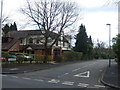
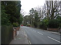
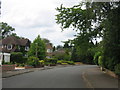
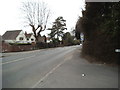
Area Overview for B74 4QD
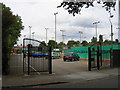
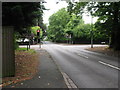
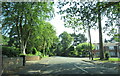
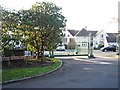
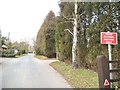
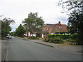
Photos of B74 4QD
Area Information
Living in the B74 4QD postcode involves residing in a specific residential cluster with a total area of just 2,275 square metres. This compact size contrasts sharply with its population of 1,715 people, creating a dense living environment where neighbours are likely to be close by. The area sits within the broader context of Sutton Coldfield, a royal town in the West Midlands that became part of Birmingham in 1974. Historically significant, Sutton Coldfield stretches back to the Bronze Age and served as a hunting ground for Mercian leaders before being granted a Royal Charter by King Henry VIII in 1528. The town features landmarks such as Sutton Park, which dates to medieval deer park origins, and the Historic Royal College. Residents of the B74 4QD postcode benefit from a location with a strong sense of place defined by its history and proximity to established town centres. The area is characterised by established housing rather than transient accommodation, reflecting a stable community structure. While the specific postal sector is small, it connects residents to the wider Sutton Coldfield infrastructure, including major roads and rail networks that link the town to Lichfield and beyond. The character of the area remains rooted in its past as a place of industry and royal significance, now functioning as a residential pocket within a larger metropolitan framework. For those considering a move, the immediate surroundings offer a mix of historical charm and modern convenience typical of the West Midlands region.
- Area Type
- Postcode
- Area Size
- 2275 m²
- Population
- 1715
- Population Density
- 573 people/km²
The property market in the B74 4QD postcode is dominated by owner-occupiers, with 95% of households owning their homes. This exceptionally high figure indicates a market where buying, rather than renting, is the primary mode of market entry. The accommodation type data confirms that the housing stock comprises houses, meaning the area lacks the flat-based inventory found in dense urban city centres. For buyers looking for homes in B74 4QD, this means encountering established residential streets rather than converted blocks or newer estates. The area functions as a specialised rural pocket within the postcode area, where the majority of transactions involve standard house sales between private individuals. As an area where 95% of residents own their property, the B74 4QD postcode is likely to see price fluctuations driven by local buyer demand and broader regional trends in Sutton Coldfield. This high ownership rate creates a more stable market environment where speculation or rapid turnover is less common. Buyers seeking to purchase homes near the Birmingham boundary will find this postcode offers a distinct character different from the high-density housing found further into the urban sprawl. The predominance of houses suggests that garden space and traditional building styles are the norm. For those considering investment, the monotony of high ownership can be viewed as a stabilising force, though it also implies fewer rental opportunities for landlords targeting this specific cluster. The market reflects the settled nature of the community, where property is viewed as a long-term asset rather than a short-term rental yield.
House Prices in B74 4QD
Showing 2 properties
| Address | Type | Beds | Baths | Last Sale Price | Last Sale Date | |
|---|---|---|---|---|---|---|
| 190 Walsall Road, Sutton Four Oaks, Sutton Coldfield, B74 4QD | house | - | - | £660,000 | Apr 2017 | |
| 192 Walsall Road, Sutton Four Oaks, Sutton Coldfield, B74 4QD | house | - | - | - | - |
Energy Efficiency in B74 4QD
Daily life for residents of the B74 4QD postcode is enriched by access to five retail outlets and five railway stations located nearby. Shoppers can visit Co-op Clarence, Tesco Walsall, or Sainsburys Sutton for groceries and daily essentials, ensuring that routine errands do not require extensive travel. Five railway stations including Butlers Lane, Blake Street, and Four Oaks provide flexible transport options for commuting or visiting friends outside the immediate area. The lifestyle in this postcode is characterised by convenience and accessibility to the wider Sutton Coldfield infrastructure. The presence of these amenities means that residents can satisfy most daily needs without leaving the immediate vicinity. The area's connection to Sutton Coldfield's historic character is evident in nearby landmarks such as Sutton Park and Holy Trinity Church. While specific dining venues are not listed in the immediate amenity data, the proximity to Sainsburys Sutton and Co-op Clarence offers opportunities for pre-packaged meals and local provisions. The transport links further enhance the lifestyle by providing easy access to Birmingham and the surrounding Midlands region. Residents who value a balance between rural quiet and urban accessibility will find this postcode appealing. The combination of reliable goods availability and rail connectivity means that living in B74 4QD involves neither isolation nor the congestion of a city centre, but rather a comfortable middle ground.
Amenities
Schools
| Rank | School | Type | Entry gender | Ages |
|---|
Explore more schools in this area
Go to Schools tabDemographics
The community within the B74 4QD postcode is defined by an mature demographic profile with a median age of 47 years. Adults between the ages of 30 and 64 constitute the most common age range, indicating the area attracts families or individuals in the middle of their working lives. Home ownership is exceptionally high, with 95% of residents owning their properties outright. This statistic suggests a settled population where residents have established long-term roots in the locality rather than chasing short-term rental opportunities. The predominant ethnic group is White, reflecting the traditional demographic composition of many postcodes in the wider Midlands region. Accommodation in the B74 4QD area consists primarily of houses, aligning with the high home ownership rate and the preferences of families who value space within a built-up area. With a population density of 573 people per square kilometre, the area offers a balance between the convenience of urban living and the familiarity of a semi-rural residential street. Half of all adults in the area are aged between 30 and 64, a group often associated with stability and investment in their local community. The high concentration of property owners indicates that this postcode is not a gateway area for transient workers but a destination for those seeking permanence. The demographic data paints a picture of a quiet, established neighbourhood where residents have likely lived there for significant periods.
Household Size
Accommodation Type
Tenure
Ethnic Group
Religion
Household Composition
Age
Household Deprivation
NS-SEC
Explore more demographic insights in this area
Go to Demographics tabPlanning
Planning Constraints
- Flood RiskPremium
- Ramsar Wetland SitesPremium
- Area of Outstanding Natural BeautyPremium
- Protected Nature ReservePremium
- Protected WoodlandPremium