Area Overview for B74 4PE
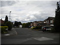
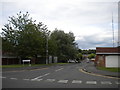
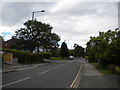
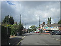
Photos of B74 4PE


Area Information
Living in B74 4PE means inhabiting a compact, residential postcode area within Sutton Coldfield, a royal town in the West Midlands. With a population of 1,586 and a density of 1,503 people per square kilometre, this small cluster of homes reflects a tight-knit community. Historically part of the Mercian kingdom, Sutton Coldfield became a suburb of Birmingham in 1974, blending medieval heritage with modern convenience. The area’s proximity to Sutton Park, a medieval deer park, offers green space within reach, while nearby railway stations and retail hubs provide practical connectivity. Daily life here is shaped by a mature demographic, with homes predominantly owner-occupied and a focus on stability. Families benefit from a cluster of primary schools, and the low crime risk score of 76/100 suggests a safe environment. For buyers, B74 4PE offers a blend of historical character and contemporary amenities, ideal for those seeking a balanced lifestyle with access to local services and transport links.
- Area Type
- Postcode
- Area Size
- Not available
- Population
- 1586
- Population Density
- 1503 people/km²
The property market in B74 4PE is characterised by a high rate of home ownership (69%) and a predominance of houses, indicating a largely owner-occupied area with limited rental activity. This suggests a stable market where properties are likely to be held long-term rather than used as investment assets. The focus on houses, as opposed to flats or apartments, aligns with the area’s residential density and historical development patterns. For buyers, this means a market that prioritises family homes and established properties, though the small size of the postcode area may limit availability. The lack of significant rental demand could mean fewer short-term opportunities for investors, but for those seeking a permanent residence, the area offers a mix of traditional housing stock with potential for long-term value retention. Proximity to nearby amenities and transport links further enhances its appeal for homebuyers prioritising convenience and community.
House Prices in B74 4PE
No properties found in this postcode.
Energy Efficiency in B74 4PE
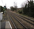
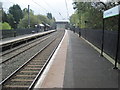
Daily life in B74 4PE is supported by a range of nearby amenities, including retail stores like Tesco Walsall, Co-op Clarence, and Sainsburys Sutton, which provide essential shopping and dining options. The five nearby railway stations—Butlers Lane, Blake Street, and Four Oaks—offer convenient access to public transport, facilitating travel to work, leisure, or social activities. While the data does not specify parks or leisure facilities, the proximity to Sutton Park, a historic green space, is implied through local research. The area’s compact size ensures that essential services are within practical reach, reducing the need for long commutes. The mix of retail and transport options contributes to a convenient lifestyle, balancing local convenience with broader connectivity. For residents, this means a practical environment where daily needs can be met without excessive travel, enhancing overall quality of life.
Amenities
Schools
Residents of B74 4PE have access to multiple primary schools, including Hill West Infant School, Hill West Junior School, and Hill West Primary School, which holds an Ofsted rating of ‘good’. These institutions cater to younger children, providing a range of educational options within the area. The presence of three primary schools suggests a focus on early education, though no secondary schools are listed in the data. For families with children, the availability of multiple primary schools reduces competition for places and offers flexibility in choosing a school. The ‘good’ rating at Hill West Primary School indicates a satisfactory standard of education, though parents may need to consider further schooling options beyond primary level. The concentration of schools in the area reflects the community’s emphasis on education and family-friendly infrastructure.
| Rank | School | Type | Entry gender | Ages |
|---|
Explore more schools in this area
Go to Schools tabDemographics
The population of B74 4PE has a median age of 47, with the majority of residents aged between 30 and 64. This suggests a community of established professionals and families, reflecting a mature demographic profile. Home ownership is high at 69%, indicating a stable housing market where most residents live in their own homes rather than renting. The predominant accommodation type is houses, which aligns with the area’s residential character and lower density compared to urban centres. The predominant ethnic group is White, though specific data on diversity or deprivation levels is not provided. The age range implies a population that may be nearing retirement or in their prime working years, potentially influencing local services and amenities. The absence of detailed diversity statistics means the community’s full composition remains less defined, but the high home ownership rate and age profile suggest a cohesive, long-term resident base.
Household Size
Accommodation Type
Tenure
Ethnic Group
Religion
Household Composition
Age
Household Deprivation
NS-SEC
Explore more demographic insights in this area
Go to Demographics tabPlanning
Planning Constraints
- Flood RiskPremium
- Ramsar Wetland SitesPremium
- Area of Outstanding Natural BeautyPremium
- Protected Nature ReservePremium
- Protected WoodlandPremium