Area Overview for B74 4PD
Photos of B74 4PD
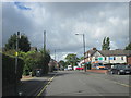
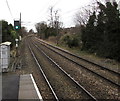
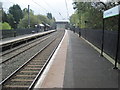
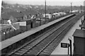
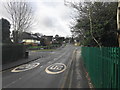
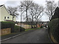
10 photos from this area
Area Information
Key information about the B74 4PD including its size, population, and administrative classification.
- Area Type
- Postcode
- Area Size
- 7335 m²
- Population
- 1464
- Population Density
- 4058 people/km²
House Prices in B74 4PD
10
Properties
£561,786
Average Sold Price
£255,000
Lowest Price
£797,500
Highest Price
Showing 10 properties
| Address | Type | Beds | Baths | Last Sale Price | Last Sale Date | |
|---|---|---|---|---|---|---|
| 43 Edge Hill Road, Sutton Coldfield, B74 4PD | house | 5 | 3 | £720,000 | Sep 2024 | |
| 45 Edge Hill Road, Sutton Coldfield, B74 4PD | house | - | - | £670,000 | Feb 2021 | |
| 41A Edge Hill Road, Sutton Coldfield, B74 4PD | Detached | 5 | - | £680,000 | Mar 2012 | |
| 37 Edge Hill Road, Sutton Coldfield, B74 4PD | Detached | 4 | 2 | £255,000 | Nov 2011 | |
| 41 Edge Hill Road, Sutton Coldfield, B74 4PD | house | - | - | £797,500 | Jan 2008 | |
| 39 Edge Hill Road, Sutton Coldfield, B74 4PD | house | - | - | £325,000 | Sep 2006 | |
| 33 Edge Hill Road, Sutton Coldfield, B74 4PD | Detached | - | - | £485,000 | Sep 2004 | |
| 35 Edge Hill Road, Sutton Coldfield, B74 4PD | Bungalow | 2 | 1 | - | - | |
| 37A Edge Hill Road, Sutton Coldfield, B74 4PD | Detached | 3 | 1 | - | - | |
| Former 43, Edge Hill Road, Sutton Coldfield, B74 4PD | Detached | - | - | - | - |
Energy Efficiency in B74 4PD
Amenities
Schools
| Rank | School | Type | Entry gender | Ages |
|---|
Explore more schools in this area
Go to Schools tabDemographics
Household Size
Family (3-5 people)
most common
Accommodation Type
Houses
most common
Tenure
72
majority
Ethnic Group
White
most common
Religion
N/A
most common
Household Composition
N/A
most common
Age
47
median
Adults (30-64 years)
most common
Household Deprivation
N/A
with no deprivation
NS-SEC
42
in Lower managerial occupations
Explore more demographic insights in this area
Go to Demographics tabPlanning
Planning Constraints
- Flood RiskPremium
- Ramsar Wetland SitesPremium
- Area of Outstanding Natural BeautyPremium
- Protected Nature ReservePremium
- Protected WoodlandPremium