Area Overview for B74 4NA
Photos of B74 4NA
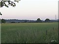
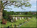
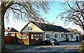
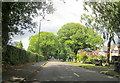
16 photos from this area
Area Information
Key information about the B74 4NA including its size, population, and administrative classification.
- Area Type
- Postcode
- Area Size
- 9233 m²
- Population
- 1464
- Population Density
- 4058 people/km²
House Prices in B74 4NA
7
Properties
£514,583
Average Sold Price
£362,500
Lowest Price
£735,000
Highest Price
Showing 7 properties
| Address | Type | Beds | Baths | Last Sale Price | Last Sale Date | |
|---|---|---|---|---|---|---|
| 24 Silver Birch Coppice, Sutton Coldfield, B74 4NA | Bungalow | - | - | £480,000 | Jan 2020 | |
| 22 Silver Birch Coppice, Sutton Coldfield, B74 4NA | Bungalow | 4 | 2 | £675,000 | Jul 2017 | |
| 18 Silver Birch Coppice, Sutton Coldfield, B74 4NA | Bungalow | - | - | £425,000 | Jan 2017 | |
| 12 Silver Birch Coppice, Sutton Coldfield, B74 4NA | house | 4 | 3 | £735,000 | Sep 2015 | |
| 20 Silver Birch Coppice, Sutton Coldfield, B74 4NA | Bungalow | 3 | 2 | £362,500 | Nov 2013 | |
| 16 Silver Birch Coppice, Sutton Coldfield, B74 4NA | Detached | - | - | £410,000 | Jun 2004 | |
| 14 Silver Birch Coppice, Sutton Coldfield, B74 4NA | Detached | - | - | - | - |
Energy Efficiency in B74 4NA
Amenities
Schools
| Rank | School | Type | Entry gender | Ages |
|---|
Explore more schools in this area
Go to Schools tabDemographics
Household Size
Family (3-5 people)
most common
Accommodation Type
Houses
most common
Tenure
72
majority
Ethnic Group
White
most common
Religion
N/A
most common
Household Composition
N/A
most common
Age
47
median
Adults (30-64 years)
most common
Household Deprivation
N/A
with no deprivation
NS-SEC
42
in Lower managerial occupations
Explore more demographic insights in this area
Go to Demographics tabPlanning
Planning Constraints
- Flood RiskPremium
- Ramsar Wetland SitesPremium
- Area of Outstanding Natural BeautyPremium
- Protected Nature ReservePremium
- Protected WoodlandPremium