Area Overview for B74 4LP
Photos of B74 4LP
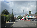
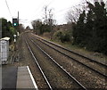
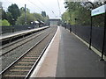

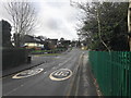
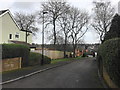
10 photos from this area
Area Information
Key information about the B74 4LP including its size, population, and administrative classification.
- Area Type
- Postcode
- Area Size
- 2.4 hectares
- Population
- 1464
- Population Density
- 4058 people/km²
House Prices in B74 4LP
55
Properties
£265,853
Average Sold Price
£85,000
Lowest Price
£530,000
Highest Price
Showing 55 properties
| Address | Type | Beds | Baths | Last Sale Price | Last Sale Date | |
|---|---|---|---|---|---|---|
| 280 Clarence Road, Sutton Four Oaks, Sutton Coldfield, B74 4LP | house | - | - | £355,000 | Mar 2025 | |
| 259 Clarence Road, Sutton Four Oaks, Sutton Coldfield, B74 4LP | Terraced | 3 | 1 | £310,000 | Nov 2024 | |
| 281 Clarence Road, Sutton Four Oaks, Sutton Coldfield, B74 4LP | Terraced | 5 | 3 | £300,000 | Mar 2024 | |
| 268 Clarence Road, Sutton Four Oaks, Sutton Coldfield, B74 4LP | house | - | - | £400,000 | Dec 2022 | |
| 278 Clarence Road, Sutton Four Oaks, Sutton Coldfield, B74 4LP | house | - | - | £438,500 | Nov 2022 | |
| 262 Clarence Road, Sutton Four Oaks, Sutton Coldfield, B74 4LP | house | - | - | £405,000 | May 2022 | |
| 245 Clarence Road, Sutton Four Oaks, Sutton Coldfield, B74 4LP | house | - | - | £405,000 | Feb 2022 | |
| 241 Clarence Road, Sutton Four Oaks, Sutton Coldfield, B74 4LP | house | - | - | £320,000 | Aug 2021 | |
| 288 Clarence Road, Sutton Four Oaks, Sutton Coldfield, B74 4LP | Semi-detached | 5 | 3 | £530,000 | Aug 2020 | |
| 257 Clarence Road, Sutton Four Oaks, Sutton Coldfield, B74 4LP | Terraced | 3 | 1 | £277,500 | Aug 2020 |
Page 1 of 6
Energy Efficiency in B74 4LP
Amenities
Schools
| Rank | School | Type | Entry gender | Ages |
|---|
Explore more schools in this area
Go to Schools tabDemographics
Household Size
Family (3-5 people)
most common
Accommodation Type
Houses
most common
Tenure
72
majority
Ethnic Group
White
most common
Religion
N/A
most common
Household Composition
N/A
most common
Age
47
median
Adults (30-64 years)
most common
Household Deprivation
N/A
with no deprivation
NS-SEC
42
in Lower managerial occupations
Explore more demographic insights in this area
Go to Demographics tabPlanning
Planning Constraints
- Flood RiskPremium
- Ramsar Wetland SitesPremium
- Area of Outstanding Natural BeautyPremium
- Protected Nature ReservePremium
- Protected WoodlandPremium