Area Overview for B74 4LB
Photos of B74 4LB
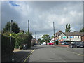
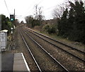
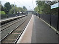

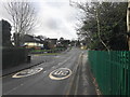
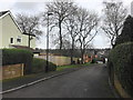
10 photos from this area
Area Information
Key information about the B74 4LB including its size, population, and administrative classification.
- Area Type
- Postcode
- Area Size
- 1.4 hectares
- Population
- 1586
- Population Density
- 1503 people/km²
House Prices in B74 4LB
22
Properties
£331,900
Average Sold Price
£54,350
Lowest Price
£735,000
Highest Price
Showing 22 properties
| Address | Type | Beds | Baths | Last Sale Price | Last Sale Date | |
|---|---|---|---|---|---|---|
| 169 Clarence Road, Sutton Four Oaks, Sutton Coldfield, B74 4LB | house | - | - | £590,000 | Aug 2024 | |
| 168 Clarence Road, Sutton Four Oaks, Sutton Coldfield, B74 4LB | Semi-detached | 3 | 1 | £464,000 | Nov 2023 | |
| 172 Clarence Road, Sutton Four Oaks, Sutton Coldfield, B74 4LB | house | - | - | £410,000 | Nov 2022 | |
| 153 Clarence Road, Sutton Four Oaks, Sutton Coldfield, B74 4LB | house | - | - | £735,000 | Oct 2022 | |
| 160 Clarence Road, Sutton Four Oaks, Sutton Coldfield, B74 4LB | Semi-detached | 3 | 1 | £310,000 | Apr 2016 | |
| 157 Clarence Road, Sutton Four Oaks, Sutton Coldfield, B74 4LB | Semi-detached | 3 | 1 | £300,000 | Aug 2015 | |
| 174 Clarence Road, Sutton Four Oaks, Sutton Coldfield, B74 4LB | house | - | - | £301,000 | Nov 2014 | |
| 155 Clarence Road, Sutton Four Oaks, Sutton Coldfield, B74 4LB | house | - | - | £275,000 | Nov 2013 | |
| 178 Clarence Road, Sutton Four Oaks, Sutton Coldfield, B74 4LB | Bungalow | 3 | - | £235,000 | Sep 2013 | |
| 161 Clarence Road, Sutton Four Oaks, Sutton Coldfield, B74 4LB | Detached | - | - | £330,000 | May 2012 |
Page 1 of 3
Energy Efficiency in B74 4LB
Amenities
Schools
| Rank | School | Type | Entry gender | Ages |
|---|
Explore more schools in this area
Go to Schools tabDemographics
Household Size
Two person
most common
Accommodation Type
Houses
most common
Tenure
69
majority
Ethnic Group
White
most common
Religion
N/A
most common
Household Composition
N/A
most common
Age
47
median
Adults (30-64 years)
most common
Household Deprivation
N/A
with no deprivation
NS-SEC
39
in Lower managerial occupations
Explore more demographic insights in this area
Go to Demographics tabPlanning
Planning Constraints
- Flood RiskPremium
- Ramsar Wetland SitesPremium
- Area of Outstanding Natural BeautyPremium
- Protected Nature ReservePremium
- Protected WoodlandPremium