Area Overview for B74 4HB
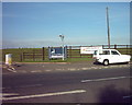
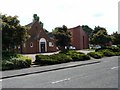
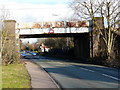
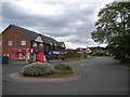
Photos of B74 4HB


Area Information
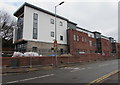
Living in B74 4HB means being part of a small, tightly knit residential cluster in Sutton Coldfield, a royal town with a rich medieval heritage. The area’s population of 1,586 people is densely packed at 1,503 per square kilometre, reflecting its compact nature. Historically, Sutton Coldfield was granted a Royal Charter by Henry VIII in 1528, and its streets still bear traces of this legacy, from medieval deer parks to 16th-century grammar schools. Today, the area is characterised by a mature community, with a median age of 47 and a strong presence of adults aged 30–64. Most homes are owner-occupied, and the housing stock is dominated by traditional houses rather than flats, suggesting a stable, long-term resident base. Proximity to key amenities like primary schools, rail stations, and local shops makes it practical for families and commuters. The area’s blend of historical significance and modern convenience offers a unique living experience, though its small size means it is best suited for those prioritising community over expansive space.
- Area Type
- Postcode
- Area Size
- Not available
- Population
- 1586
- Population Density
- 1503 people/km²
The property market in B74 4HB is dominated by owner-occupied homes, with 69% of properties owned by residents rather than rented. This suggests a community of long-term residents invested in local stability. The accommodation type is primarily houses, which are more common than flats in this area. This housing stock likely reflects the town’s historical development, with traditional homes suited to families or those preferring larger living spaces. Given the area’s small size and high population density, the housing market may be limited, with competition for available properties. Buyers should consider the compact nature of the area, as expansion options are constrained by its residential cluster designation. The predominance of owner-occupied homes also implies a focus on long-term investment rather than short-term rental opportunities, which could influence property values and availability.
House Prices in B74 4HB
No properties found in this postcode.
Energy Efficiency in B74 4HB
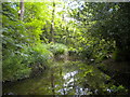
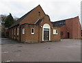
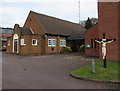
Residents of B74 4HB have access to essential amenities within practical reach, including five retail outlets such as Co-op Clarence, Tesco Walsall, and Sainsburys Sutton. These stores provide convenience for grocery shopping and daily needs. The area’s proximity to rail stations like Butlers Lane and Four Oaks enhances mobility, connecting residents to broader networks. Historically, Sutton Coldfield is home to Sutton Park, a medieval deer park that remains a green space for recreation. While not explicitly listed in the data, the area’s research highlights its conservation areas, historic churches, and the Royal Hotel, suggesting a blend of heritage and local charm. The presence of primary schools and rail links supports a family-oriented lifestyle, with opportunities for both cultural engagement and practical living. The compact nature of the area ensures that amenities are easily accessible, though its small size may limit options for those seeking expansive leisure facilities.
Amenities
Schools
The schools nearest to B74 4HB include Hill West Infant School, Hill West Junior School, and Hill West Primary School, all of which are primary institutions. One of the primary schools holds a ‘good’ Ofsted rating, indicating a strong educational offering for younger children. The concentration of primary schools in the area suggests a family-friendly environment, with multiple options for parents seeking schooling for their children. The presence of a ‘good’-rated school adds value for families prioritising education quality. While no secondary schools are listed, the proximity to primary education may be complemented by nearby secondary institutions in Sutton Coldfield. The mix of schools provides flexibility for families, though specific details on their curricula or performance beyond the Ofsted rating are not available.
| Rank | School | Type | Entry gender | Ages |
|---|
Explore more schools in this area
Go to Schools tabDemographics
The community in B74 4HB is predominantly composed of adults aged 30–64, with a median age of 47. This suggests a mature population, likely including families and professionals settled in the area. Home ownership is high at 69%, indicating a stable, long-term resident base with a focus on property investment. The accommodation type is primarily houses, which aligns with the area’s historical character and may appeal to those seeking traditional living spaces. The predominant ethnic group is White, though specific data on diversity or deprivation is not provided. The age profile implies a mix of working-age individuals and older residents, which may influence local services and community dynamics. With no data on deprivation levels, it is difficult to assess broader socioeconomic challenges, but the high home ownership rate and presence of primary schools suggest a reasonably well-supported environment for families.
Household Size
Accommodation Type
Tenure
Ethnic Group
Religion
Household Composition
Age
Household Deprivation
NS-SEC
Explore more demographic insights in this area
Go to Demographics tabPlanning
Planning Constraints
- Flood RiskPremium
- Ramsar Wetland SitesPremium
- Area of Outstanding Natural BeautyPremium
- Protected Nature ReservePremium
- Protected WoodlandPremium