Area Overview for B74 4DF
Photos of B74 4DF
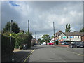
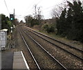


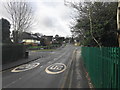
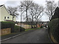
10 photos from this area
Area Information
Key information about the B74 4DF including its size, population, and administrative classification.
- Area Type
- Postcode
- Area Size
- 1.5 hectares
- Population
- 1586
- Population Density
- 1503 people/km²
House Prices in B74 4DF
23
Properties
£446,105
Average Sold Price
£123,000
Lowest Price
£745,000
Highest Price
Showing 23 properties
| Address | Type | Beds | Baths | Last Sale Price | Last Sale Date | |
|---|---|---|---|---|---|---|
| 6 Wall Drive, Sutton Coldfield, B74 4DF | Bungalow | 4 | 2 | £745,000 | Jun 2024 | |
| 19 Wall Drive, Sutton Coldfield, B74 4DF | Detached | 5 | 3 | £440,000 | Jun 2024 | |
| 21 Wall Drive, Sutton Coldfield, B74 4DF | Bungalow | 3 | 2 | £430,000 | Mar 2024 | |
| 22 Wall Drive, Sutton Coldfield, B74 4DF | house | - | - | £705,000 | Jun 2023 | |
| 7 Wall Drive, Sutton Coldfield, B74 4DF | Detached | 4 | 3 | £665,000 | May 2023 | |
| 16 Wall Drive, Sutton Coldfield, B74 4DF | house | 4 | - | £605,000 | Jun 2022 | |
| 15 Wall Drive, Sutton Coldfield, B74 4DF | house | 4 | - | £643,000 | Sep 2021 | |
| 18 Wall Drive, Sutton Coldfield, B74 4DF | Detached | 4 | 1 | £555,000 | Dec 2020 | |
| 10 Wall Drive, Sutton Coldfield, B74 4DF | Detached | 3 | 1 | £445,000 | Jun 2019 | |
| 12 Wall Drive, Sutton Coldfield, B74 4DF | Detached | 3 | 1 | £380,000 | Jun 2019 |
Page 1 of 3
Energy Efficiency in B74 4DF
Amenities
Schools
| Rank | School | Type | Entry gender | Ages |
|---|
Explore more schools in this area
Go to Schools tabDemographics
Household Size
Two person
most common
Accommodation Type
Houses
most common
Tenure
69
majority
Ethnic Group
White
most common
Religion
N/A
most common
Household Composition
N/A
most common
Age
47
median
Adults (30-64 years)
most common
Household Deprivation
N/A
with no deprivation
NS-SEC
39
in Lower managerial occupations
Explore more demographic insights in this area
Go to Demographics tabPlanning
Planning Constraints
- Flood RiskPremium
- Ramsar Wetland SitesPremium
- Area of Outstanding Natural BeautyPremium
- Protected Nature ReservePremium
- Protected WoodlandPremium