Area Overview for B74 4BU
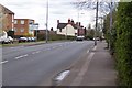
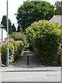
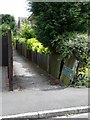
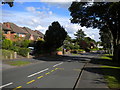
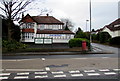
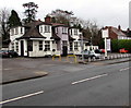
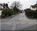
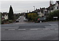
Photos of B74 4BU


Area Information
Living in B74 4BU means being part of a small, tightly knit residential cluster in England’s West Midlands. With a population of 1,721, this area offers a quiet, stable environment where most residents are adults aged 30–64. The postcode sits within a historically rich region, once a royal town known as Sutton Coldfield, which became part of Birmingham in 1974. Its name reflects its origins as a “south town” near Tamworth, with echoes of medieval heritage still visible in local landmarks like Sutton Park and Bishop Vesey’s Grammar School. Daily life here balances suburban calm with practical connectivity: rail stations like Butlers Lane and Four Oaks provide easy access to nearby towns, while nearby shops and amenities ensure convenience. The area’s low flood risk and absence of environmental constraints make it appealing for families and professionals seeking a blend of historical character and modern essentials.
- Area Type
- Postcode
- Area Size
- Not available
- Population
- 1721
- Population Density
- 3129 people/km²
The property market in B74 4BU is characterised by high home ownership (75%) and a focus on houses rather than flats or apartments. This suggests a community of established residents, many of whom may have lived in the area for years. The predominance of houses implies larger homes with gardens, appealing to families or those prioritising space. As a small postcode area, the housing stock is limited, so buyers may need to consider nearby zones for more options. The market likely values stability and proximity to amenities like rail stations and local shops. For buyers, this means a potential focus on long-term residency rather than short-term rental opportunities, with property values possibly reflecting the area’s historical appeal and practical connectivity.
House Prices in B74 4BU
No properties found in this postcode.
Energy Efficiency in B74 4BU
Residents of B74 4BU have access to a range of nearby amenities that support daily life. The retail sector includes five shops, such as Aldi on Belwell Lane, Lidl in Sutton, and Cook Mere, providing convenience for groceries and essentials. Rail stations like Butlers Lane and Four Oaks offer easy access to public transport, connecting to Birmingham and surrounding areas. While the area lacks large supermarkets or entertainment hubs, the proximity to Sutton Coldfield’s historical sites, such as Sutton Park and Bishop Vesey’s Grammar School, adds cultural and recreational value. The small-scale nature of the postcode means amenities are closely clustered, fostering a sense of community. For those who enjoy walking or cycling, the local rail network and nearby green spaces offer a balance of practicality and leisure.
Amenities
Schools
| Rank | School | Type | Entry gender | Ages |
|---|
Explore more schools in this area
Go to Schools tabDemographics
The community in B74 4BU is predominantly middle-aged, with a median age of 47 and most residents falling within the 30–64 age range. Home ownership is high, at 75%, suggesting a stable, long-term population. The accommodation type is primarily houses, reflecting a residential area with larger properties rather than apartments or flats. The predominant ethnic group is White, which aligns with broader trends in the region. This demographic profile indicates a community focused on family living and long-term investment, with fewer transient residents. The absence of specific deprivation data means quality of life is likely shaped by local amenities and infrastructure, such as the nearby rail network and retail options.
Household Size
Accommodation Type
Tenure
Ethnic Group
Religion
Household Composition
Age
Household Deprivation
NS-SEC
Explore more demographic insights in this area
Go to Demographics tabPlanning
Planning Constraints
- Flood RiskPremium
- Ramsar Wetland SitesPremium
- Area of Outstanding Natural BeautyPremium
- Protected Nature ReservePremium
- Protected WoodlandPremium