Area Overview for B74 4BG
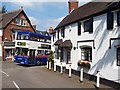
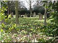
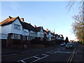
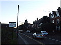
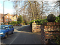
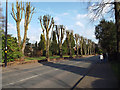
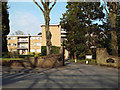
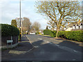
Photos of B74 4BG


Area Information
Living in B74 4BG means inhabiting a small, densely populated residential cluster in England’s West Midlands. With 1,672 residents spread across 1.296 people per square kilometre, this area is compact yet functional. The community is defined by its mature demographic, with a median age of 47 and a majority of residents aged 30–64. This suggests a stable, established population, likely with long-term ties to the area. The postcode is part of a broader region with historical significance, though its modern character is shaped by practical considerations: 62% of homes are owner-occupied, and the accommodation is predominantly houses. Daily life here balances proximity to amenities with a sense of quiet residential living. The area’s connectivity is strong, with broadband rated excellent and mobile coverage good, supporting both work and leisure. While the population density is high, the small scale of B74 4BG means it feels more like a tight-knit community than a sprawling suburb. For those seeking a place with a mix of historical roots and modern convenience, B74 4BG offers a snapshot of suburban England.
- Area Type
- Postcode
- Area Size
- Not available
- Population
- 1672
- Population Density
- 1296 people/km²
The property market in B74 4BG is characterised by a high rate of home ownership—62% of residents own their homes. This suggests a market where private ownership is the norm rather than a rental-dominated area. The accommodation type is predominantly houses, which is unusual for smaller postcode areas and may indicate a preference for detached or semi-detached housing. This mix of ownership and housing type implies a stable market with properties that are likely to retain value. For buyers, the focus on owner-occupied homes means competition may be keen, particularly for family-friendly properties. The small scale of the area means that the immediate surroundings are likely to have a similar housing stock, with limited variation in property types. Prospective buyers should consider that the market may be less dynamic than larger urban areas, with fewer new developments and a stronger emphasis on existing homes.
House Prices in B74 4BG
No properties found in this postcode.
Energy Efficiency in B74 4BG
Residents of B74 4BG have access to nearby retail amenities, including Aldi Belwell Lane, Cook Mere, and Lidl Sutton, offering everyday shopping needs. The area’s railway stations—Butlers Lane, Four Oaks, and Blake Street—provide connections to broader networks, facilitating travel to nearby towns and cities. While the data does not mention parks or leisure facilities directly, the proximity to Sutton Coldfield—a town with historical sites like Sutton Park and Holy Trinity Church—suggests cultural and recreational opportunities within reach. The retail options and rail links contribute to a practical lifestyle, balancing convenience with the potential for exploring the region’s heritage. The mix of local shops and transport hubs ensures daily life is efficient, though buyers should verify whether specific leisure amenities are within walking distance.
Amenities
Schools
Near B74 4BG, primary schools include Mere Green Combined School, Ley Hill Junior School, Ley Hill Infants’ School, and Mere Green Primary School, which holds an outstanding Ofsted rating. These schools cater to younger children, with a mix of combined and specialist infant and junior provision. The presence of four primary schools within proximity offers families multiple options, though no secondary schools are listed in the data. The outstanding rating at Mere Green Primary School indicates a high standard of education in at least one institution, which could be a draw for families prioritising academic quality. However, the absence of secondary schools may require residents to travel further for secondary education. The density of primary schools suggests a focus on early years education, aligning with the area’s demographic of adults aged 30–64, many of whom may have school-age children.
| Rank | School | Type | Entry gender | Ages |
|---|
Explore more schools in this area
Go to Schools tabDemographics
The population of B74 4BG is 1,672, with a median age of 47, indicating a mature community. The most common age group is adults aged 30–64, making up the majority of residents. This suggests a stable demographic with a focus on family life and long-term residency. Home ownership is high at 62%, reflecting a preference for owning property over renting. The accommodation type is predominantly houses, which aligns with the area’s residential character. The predominant ethnic group is White, though specific data on diversity or deprivation is not provided. The age profile implies a community with established careers and family structures, likely with a lower proportion of young professionals or students. The high home ownership rate and mature age range suggest a low turnover of residents, contributing to a cohesive local identity. For buyers, this demographic profile indicates a market where properties are likely to remain in private hands for extended periods.
Household Size
Accommodation Type
Tenure
Ethnic Group
Religion
Household Composition
Age
Household Deprivation
NS-SEC
Explore more demographic insights in this area
Go to Demographics tabPlanning
Planning Constraints
- Flood RiskPremium
- Ramsar Wetland SitesPremium
- Area of Outstanding Natural BeautyPremium
- Protected Nature ReservePremium
- Protected WoodlandPremium