Area Overview for B74 3SN
Photos of B74 3SN


Area Information
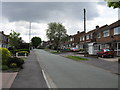
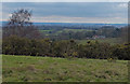
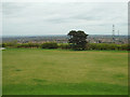
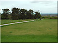
Living in B74 3SN means inhabiting a small, residential cluster in the semi-rural to suburban district of Streetly, West Midlands. With a population of 1,425, this area sits within the northern reaches of Birmingham’s metropolitan sprawl, bordered by New Oscott, Great Barr, and Little Aston. Historically rooted in Roman roads and 19th-century railway development, Streetly retains traces of its past while evolving into a modern suburb. Its character is defined by open spaces, including access to Sutton Park, and a layout of private homes built predominantly from the 1960s onwards. Daily life here balances suburban convenience with proximity to green belt land, offering a quieter alternative to city living. The area’s transformation from rural Staffordshire to a suburban district reflects its role in accommodating Birmingham’s growth. Residents benefit from nearby transport hubs, retail options, and a community shaped by long-term home ownership, creating a stable, low-maintenance lifestyle.
- Area Type
- Postcode
- Area Size
- Not available
- Population
- 1425
- Population Density
- 2276 people/km²
The property market in B74 3SN is characterised by high home ownership (92%) and a predominance of houses, reflecting a suburban rather than urban housing stock. This suggests a community of long-term residents, many of whom may have purchased properties during the post-war housing boom of the 1960s and beyond. The area’s small size means the housing stock is limited, but the focus on private ownership implies limited rental availability. Buyers should expect a market where properties are likely to be family homes, often in need of modernisation given their age. Proximity to Sutton Park and nearby transport links adds value, though the area’s semi-rural character may appeal to those seeking space without full countryside isolation.
House Prices in B74 3SN
No properties found in this postcode.
Energy Efficiency in B74 3SN
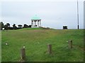
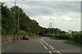
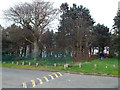
Life in B74 3SN is shaped by its proximity to Sutton Park, a major green space with a dedicated entrance for residents. Nearby shops include M&S Foley BP, Tesco Streetly, and Waitrose Little, offering everyday essentials. The area’s transport links to rail and metro services ensure easy access to retail, dining, and leisure in nearby towns. Historical sites like the Parson & Clerk Inn, marking the start of the Roman Ryknield Street, add cultural depth. The semi-rural setting, combined with modern housing and retail amenities, creates a lifestyle that prioritises convenience without sacrificing green space.
Amenities
Schools
| Rank | School | Type | Entry gender | Ages |
|---|
Explore more schools in this area
Go to Schools tabDemographics
The population of B74 3SN is 1,425, with a median age of 47 and the majority of residents falling within the 30–64 age range. This suggests a community of established adults, many of whom are likely in their prime working years or nearing retirement. Home ownership is exceptionally high at 92%, indicating a strong preference for private residence over rental properties. The accommodation type is predominantly houses, reflecting a suburban layout rather than high-density housing. The predominant ethnic group is White, though no specific diversity metrics are provided. The age profile and ownership rates suggest a mature, settled population with long-term ties to the area. With no data on deprivation or income distribution, the focus remains on the demographic stability and the presence of family-oriented housing.
Household Size
Accommodation Type
Tenure
Ethnic Group
Religion
Household Composition
Age
Household Deprivation
NS-SEC
Explore more demographic insights in this area
Go to Demographics tabPlanning
Planning Constraints
- Flood RiskPremium
- Ramsar Wetland SitesPremium
- Area of Outstanding Natural BeautyPremium
- Protected Nature ReservePremium
- Protected WoodlandPremium