Area Overview for B74 3QD
Photos of B74 3QD
Area Information
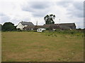
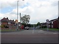
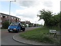
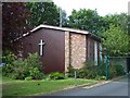
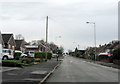
The B74 3QD postcode represents a specific residential cluster within the broader half-acre suburb of Streetly. This area spans just 9,835 square metres yet houses 1,601 residents, creating a tightly knit community environment. Streetly itself is a semi-rural to suburban district located in the northern part of the Birmingham metropolitan area. It sits adjacent to New Oscott, Great Barr, Four Oaks, Little Aston, and Aldridge, while remaining separated from Walsall by open fields and the North Birmingham green belt. You retain easy access to Sutton Park, which features its own dedicated gate off Foley Road in this locale. The name derives from Ryknield Street, a Roman road whose line can still be followed within the park. Historical records show an Anglo-Saxon Charter granted an estate here in 959. The Midland Railway Company opened a station at the corner of Foley Road and Thornhill Road in 1879, which closed in 1965. Today, the area combines modern housing stock from the 1960s onwards with significant open space and farms. Living in B74 3QD means settling in a district that transformed from a rural Staffordshire settlement into a residential suburb following mass construction in the mid-20th century. The presence of the Parson & Clerk Inn and several churches built between 1908 and the 1970s underscores the area's long residential history alongside its modern development.
- Area Type
- Postcode
- Area Size
- 9835 m²
- Population
- 1601
- Population Density
- 3538 people/km²
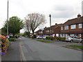
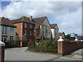
Properties in B74 3QD are exclusively houses, reflecting the area's suburban and semi-rural character. With 92% of residents owning their homes, the local market is overwhelmingly owner-occupied rather than rental-based. This high ownership figure implies that the neighbourhood consists largely of families and individuals with established financial footing. The accommodation type data confirms that you will not find flats or purpose-built apartments in this specific cluster. Instead, the housing stock comprises standalone or semi-detached residences typical of development periods dating back to the 1960s and beyond. Mass housing construction transformed the area from a sparse rural patch into a residential suburb. This history means many homes have established value and character within the built environment. Buyers looking at this small area can expect a market driven by owner-motivated sellers rather than institutional landlords. The high concentration of owner-occupiers often results in stable local investment and community stewardship. When evaluating homes in B74 3QD, focus on individual property condition rather than association management fees common in flat developments. The 92% ownership rate signals a traditional English suburban model of homeownership where residents invest directly in their living space. This dynamic creates a distinct market rhythm compared to cities with higher rental pressures or significant block condominiums.
House Prices in B74 3QD
Showing 23 properties
| Address | Type | Beds | Baths | Last Sale Price | Last Sale Date | |
|---|---|---|---|---|---|---|
| 29 Ferndale Road, Streetly, B74 3QD | Semi-detached | 3 | 2 | £367,500 | Feb 2025 | |
| 37 Ferndale Road, Streetly, B74 3QD | Semi-detached | 3 | 1 | £380,000 | Sep 2023 | |
| 17 Ferndale Road, Streetly, B74 3QD | Detached | 5 | 2 | £376,000 | Jan 2020 | |
| 38 Ferndale Road, Streetly, B74 3QD | house | - | - | £285,000 | Nov 2019 | |
| 26 Ferndale Road, Streetly, B74 3QD | Semi-detached | 3 | 1 | £275,000 | Oct 2018 | |
| 21 Ferndale Road, Streetly, B74 3QD | Semi-detached | 3 | 1 | £280,000 | Mar 2016 | |
| 28 Ferndale Road, Streetly, B74 3QD | house | - | - | £185,000 | Aug 2014 | |
| 30 Ferndale Road, Streetly, B74 3QD | house | 3 | - | £174,000 | Oct 2012 | |
| 23 Ferndale Road, Streetly, B74 3QD | house | 3 | - | £160,000 | Mar 2011 | |
| 44 Ferndale Road, Streetly, B74 3QD | Semi-detached | - | - | £185,000 | May 2004 |
Energy Efficiency in B74 3QD
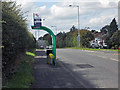
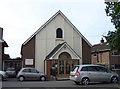
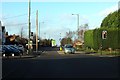
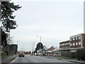
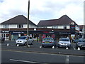
Residents of B74 3QD enjoy immediate access to a range of amenities within practical reach. Five retail outlets are located nearby, including Tesco Streetly, Waitrose Little, and M&S Foley BP. These venues provide comprehensive shopping for groceries and household essentials. Five railway stations lie within easy commuting distance, notably Butlers Lane Railway Station, Four Oaks Railway Station, and Blake Street Railway Station. Additionally, five Metro stops offer access to the West Midlands Metro network, with Winson Green Outer Circle, Soho Benson Road, and Handsworth Booth Street among the options. Beyond transport and retail, Sutton Park offers extensive leisure space with a dedicated gate for Streetly. The Parson & Clerk Inn marks the historical starting point of Ryknield Street within the park. Historical landmarks include a church built in Foley Road in 1908 and St. Anne's Roman Catholic Church. Facilities from the 1960–1970 period include a clinic and library on Blackwood Road. This combination of modern retail, public transit, and green space defines daily life. You can manage weekly shopping trips, school runs, and commuting without leaving the immediate vicinity. The presence of Restaurants or leisure venues centres on the access to the park and town centres. Living here blends suburban convenience with historical charm and accessible recreation.
Amenities
Schools
Families in B74 3QD have access to two specific primary schools situated nearby. Manor Primary School serves as a local option with an Ofsted rating of good. St Anne's Catholic Primary School, located in Streetly, holds an outstanding Ofsted rating. These institutions represent the primary education catchment for households in this area. The mix includes both community primary and faith-based primary choices. Both schools operate at a professional standard recognised by the regulatory body. Living in B74 3QD places your children within practical reach of these established learning environments. The presence of an outstanding-rated school often appeals to families prioritising high educational standards. Manor Primary offers a solid baseline of quality education in the region. St Anne's Catholic Primary adds a faith-based dimension to local schooling options. Parents choosing homes in this postcode will weigh the outstanding rating of one school against the good rating of the other. The proximity ensures that students avoid long commutes to secondary centres. These schools form the core of the local educational infrastructure for this specific residential cluster.
| Rank | School | Type | Entry gender | Ages |
|---|
Explore more schools in this area
Go to Schools tabDemographics
The community in B74 3QD is defined by a mature demographic profile where the median age stands at 47 years. Adults between 30 and 64 years old constitute the most common age range. Ownership of property dominates the landscape, with 92% of residents owning their homes. Nearly all residential units are houses rather than apartments or flats. This high rate of ownership suggests a settled population rather than a transient one. White residents form the predominant ethnic group in this neighbourhood. Such statistics indicate a stable, established community where long-term residents have invested heavily in their properties. A home ownership rate of 92% typically correlates with lower property churn and a desire for lasting neighbourhood improvements. The concentration of older adults and families with young children supports local schools and family-focused amenities. The lack of high-density flats aligns with the semi-rural character of the adjacent green belt and farm land. Residents here likely prioritise space and tenure security over urban convenience. The demographic makeup reflects a neighbourhood that has matured since the significant housing developments of the post-war era transformed the district from agricultural land into a residential zone.
Household Size
Accommodation Type
Tenure
Ethnic Group
Religion
Household Composition
Age
Household Deprivation
NS-SEC
Explore more demographic insights in this area
Go to Demographics tabPlanning
Planning Constraints
- Flood RiskPremium
- Ramsar Wetland SitesPremium
- Area of Outstanding Natural BeautyPremium
- Protected Nature ReservePremium
- Protected WoodlandPremium