Area Overview for B74 3PG
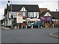
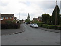
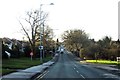
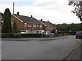
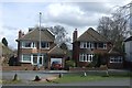
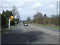
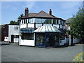
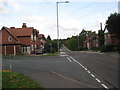
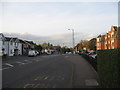
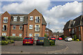
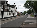
Photos of B74 3PG
Area Information
Living in B74 3PG means residing within a compact residential cluster of 2.2 hectares that forms part of the wider Streetly district in the West Midlands. This specific postcode area houses 1,601 people, creating a tight-knit community with a population density of 71,841 people per square kilometre. While the broader Streetly area retains a semi-rural character with access to Sutton Park through a dedicated gate, B74 3PG itself functions as a focused residential hub. The district lies in the northern part of Birmingham, bordered by New Oscott, Great Barr, and Walsall, separated from the latter by open fields and the North Birmingham Green Belt. Historically, the name derives from Ryknield Street, a Roman road that still influences the area's layout, although modern housing development since the 1960s has largely replaced earlier rural estates. You will find yourself in an established neighbourhood where the past meets the present, with transport links centred on the M6 motorway at Great Barr and proximity to several railway stations. The area offers a quiet suburban existence distinct from the larger urban sprawl of Birmingham, yet it remains connected to key services and towns nearby.
- Area Type
- Postcode
- Area Size
- 2.2 hectares
- Population
- 1601
- Population Density
- 3538 people/km²
Homes in B74 3PG are firmly within the owner-occupied sector, with 92% of the population holding their properties outright or with a mortgage and no tenant occupancy implied by the data. This high ownership rate of 92% signals a market where long-term residents have purchased homes rather than renting, creating a stable housing stock. The predominant accommodation type is houses, fitting the pattern of post-war suburban development that transformed the area from rural land to residential zones between 1918 and 1939, and expanded again in the 1960s. For buyers looking at this small postcode cluster, the market reflects an established residential zone rather than a student or rental corridor. The 2.2 hectares of land accommodate 1,601 residents, suggesting a relatively dense neighbourhood of residential properties. This data suggests a quiet, settled market where properties are sold to families seeking stability rather than investors looking for high turnover. The prevalence of private ownership means the area is characterised by residents who have invested in their local environment over time.
House Prices in B74 3PG
Showing 29 properties
| Address | Type | Beds | Baths | Last Sale Price | Last Sale Date | |
|---|---|---|---|---|---|---|
| 56 Egerton Road, Streetly, B74 3PG | Detached | 3 | 1 | £325,000 | Oct 2025 | |
| 45 Egerton Road, Streetly, B74 3PG | Bungalow | - | - | £445,000 | Feb 2022 | |
| 41 Egerton Road, Streetly, B74 3PG | Bungalow | 4 | 4 | £392,500 | Aug 2021 | |
| 51 Egerton Road, Streetly, B74 3PG | Bungalow | - | - | £339,950 | Apr 2018 | |
| 34 Egerton Road, Streetly, B74 3PG | Detached | 3 | - | £266,000 | Jun 2013 | |
| 43 Egerton Road, Streetly, B74 3PG | Bungalow | - | - | £303,500 | Feb 2012 | |
| 37 Egerton Road, Streetly, B74 3PG | house | 3 | - | £272,500 | Oct 2011 | |
| 39 Egerton Road, Streetly, B74 3PG | Bungalow | - | - | £200,000 | Sep 2011 | |
| 46 Egerton Road, Streetly, B74 3PG | Bungalow | 4 | - | £343,000 | May 2011 | |
| 47 Egerton Road, Streetly, B74 3PG | Bungalow | 2 | 3 | £225,000 | Jan 2011 |
Energy Efficiency in B74 3PG
Daily life in B74 3PG benefits from a range of amenities located within practical reach of the 1,601 residents who call this small postcode home. Retail options include Tesco Streetly, M&S Foley BP, and Co-op Streetly, providing essential shopping needs without requiring a long drive. For leisure and recreation, Sutton Park is a major asset, with a dedicated gate serving the Streetly district. You can access the park's 2,500 acres of green space, including the historic Ryknield Street path marked by the Parson & Clerk Inn. The area also features specific community landmarks such as the church built in Foley Road in 1908 and St. Anne's Roman Catholic Church. Modern facilities established in the 1960s and 1970s include a clinic and library located on Blackwood Road. Commuters rely on nearby rail stations like Butler's Lane and Blake Street, with additional metro links available at Winson Green Outer Circle and Soho Benson Road. This mix of local shops, historic landmarks, and transport hubs creates a convenient lifestyle where daily errands and weekend outings are easily managed from your front door.
Amenities
Schools
Residential families in B74 3PG have several high-quality educational options within practical reach, with two specific schools listed in the immediate vicinity. Manor Primary School operates as a primary institution holding a 'good' Ofsted rating. Nearby, St Anne's Catholic Primary School, Streetly, also serves pupils at the primary level and holds an 'outstanding' Ofsted rating. This combination provides families with the choice between a standard-rated primary option and a highly rated Catholic primary within the same neighbourhood. For residents seeking secondary education, the data provided does not list any secondary schools with names or ratings for this specific postcode, although the area is part of the wider Birmingham metropolitan education region. The presence of an outstanding-rated Catholic school and a good-rated community primary suggests a strong commitment to primary education in the street. Parents living in this area can expect their children to attend well-performing institutions without needing to travel far to access quality provisions.
| Rank | School | Type | Entry gender | Ages |
|---|
Explore more schools in this area
Go to Schools tabDemographics
The community in B74 3PG is defined by a mature demographic profile where 92% of residents own their homes. The median age stands at 47 years, reflecting a population dominated by adults between 30 and 64 years old. This high level of home ownership indicates a stable settlement where most households have roots in the locality rather than transient populations. The area is predominantly composed of houses, aligning with the suburban character of the wider Streetly district. Ethnically, the predominant group is White, consistent with the historical development of the region. With a population density of over 71,000 people per square kilometre concentrated in just 2.2 hectares for this specific postcode, the immediate local environment feels intense, yet the surrounding Streetly district maintains a more spacious feel with access to farms and green belt land. The absence of significant younger-age or retired populations suggests a family-oriented workforce of steady homeowners rather than students or the very young.
Household Size
Accommodation Type
Tenure
Ethnic Group
Religion
Household Composition
Age
Household Deprivation
NS-SEC
Explore more demographic insights in this area
Go to Demographics tabPlanning
Planning Constraints
- Flood RiskPremium
- Ramsar Wetland SitesPremium
- Area of Outstanding Natural BeautyPremium
- Protected Nature ReservePremium
- Protected WoodlandPremium