Area Overview for B74 3EP
Photos of B74 3EP
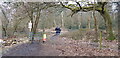
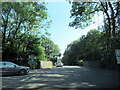
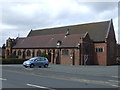
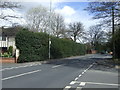
17 photos from this area
Area Information
Key information about the B74 3EP including its size, population, and administrative classification.
- Area Type
- Postcode
- Area Size
- 7259 m²
- Population
- 1519
- Population Density
- 2645 people/km²
House Prices in B74 3EP
33
Properties
£144,402
Average Sold Price
£65,000
Lowest Price
£191,000
Highest Price
Showing 33 properties
| Address | Type | Beds | Baths | Last Sale Price | Last Sale Date | |
|---|---|---|---|---|---|---|
| 14 Links View, Streetly, B74 3EP | Flat | - | - | £155,000 | Oct 2025 | |
| 36 Links View, Streetly, B74 3EP | Maisonette | - | - | £124,000 | Aug 2025 | |
| 20 Links View, Streetly, B74 3EP | Maisonette | 2 | 1 | £187,000 | Apr 2025 | |
| 21 Links View, Streetly, B74 3EP | Flat | 2 | 1 | £180,000 | Jan 2025 | |
| 7 Links View, Streetly, B74 3EP | Flat | - | - | £191,000 | Dec 2024 | |
| 18 Links View, Streetly, B74 3EP | Maisonette | 2 | 1 | £190,000 | Aug 2024 | |
| 28 Links View, Streetly, B74 3EP | Flat | 2 | 1 | £166,000 | Jul 2023 | |
| 29 Links View, Streetly, B74 3EP | Maisonette | - | - | £180,000 | Sep 2022 | |
| 31 Links View, Streetly, B74 3EP | Maisonette | - | - | £182,500 | Aug 2022 | |
| 6 Links View, Streetly, B74 3EP | Maisonette | 2 | 1 | £155,000 | Jan 2021 |
Page 1 of 4
Energy Efficiency in B74 3EP
Amenities
Schools
| Rank | School | Type | Entry gender | Ages |
|---|
Explore more schools in this area
Go to Schools tabDemographics
Household Size
Family (3-5 people)
most common
Accommodation Type
Houses
most common
Tenure
90
majority
Ethnic Group
White
most common
Religion
N/A
most common
Household Composition
N/A
most common
Age
47
median
Adults (30-64 years)
most common
Household Deprivation
N/A
with no deprivation
NS-SEC
51
in Lower managerial occupations
Explore more demographic insights in this area
Go to Demographics tabPlanning
Planning Constraints
- Flood RiskPremium
- Ramsar Wetland SitesPremium
- Area of Outstanding Natural BeautyPremium
- Protected Nature ReservePremium
- Protected WoodlandPremium