Area Overview for B74 3DN
Photos of B74 3DN
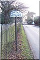

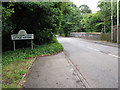
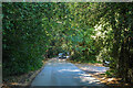
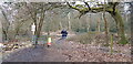
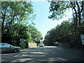
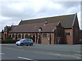
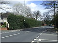

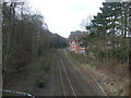
17 photos from this area
Area Information
Key information about the B74 3DN including its size, population, and administrative classification.
- Area Type
- Postcode
- Area Size
- 1.1 hectares
- Population
- 1524
- Population Density
- 1828 people/km²
House Prices in B74 3DN
13
Properties
£488,600
Average Sold Price
£140,000
Lowest Price
£860,000
Highest Price
Showing 13 properties
| Address | Type | Beds | Baths | Last Sale Price | Last Sale Date | |
|---|---|---|---|---|---|---|
| 69 Hardwick Road, Streetly, B74 3DN | house | - | - | £750,000 | Jun 2023 | |
| 51 Hardwick Road, Streetly, B74 3DN | house | - | - | £860,000 | Dec 2021 | |
| 65 Hardwick Road, Streetly, B74 3DN | Bungalow | - | - | £500,000 | May 2021 | |
| 61 Hardwick Road, Streetly, B74 3DN | Detached | 4 | 2 | £650,000 | Jan 2021 | |
| 53 Hardwick Road, Streetly, B74 3DN | Detached | 4 | 2 | £580,000 | Jul 2017 | |
| 55 Hardwick Road, Streetly, B74 3DN | Detached | 3 | - | £326,000 | Aug 2012 | |
| 47 Hardwick Road, Streetly, B74 3DN | Detached | - | - | £580,000 | Oct 2007 | |
| 67 Hardwick Road, Streetly, B74 3DN | Bungalow | 2 | 1 | £275,000 | Aug 2003 | |
| 53A Hardwick Road, Streetly, B74 3DN | Detached | - | - | £225,000 | Sep 2001 | |
| 57 Hardwick Road, Streetly, B74 3DN | Detached | - | - | £140,000 | Oct 1999 |
Page 1 of 2
Energy Efficiency in B74 3DN
Amenities
Schools
| Rank | School | Type | Entry gender | Ages |
|---|
Explore more schools in this area
Go to Schools tabDemographics
Household Size
Two person
most common
Accommodation Type
Houses
most common
Tenure
88
majority
Ethnic Group
White
most common
Religion
N/A
most common
Household Composition
N/A
most common
Age
47
median
Adults (30-64 years)
most common
Household Deprivation
N/A
with no deprivation
NS-SEC
45
in Lower managerial occupations
Explore more demographic insights in this area
Go to Demographics tabPlanning
Planning Constraints
- Flood RiskPremium
- Ramsar Wetland SitesPremium
- Area of Outstanding Natural BeautyPremium
- Protected Nature ReservePremium
- Protected WoodlandPremium