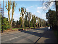
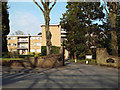
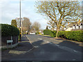
Area Overview for B74 2XS
Photos of B74 2XS

Area Information
B74 2XS represents a specific residential cluster within the broader historic context of Sutton Coldfield, a royal town in the West Midlands with a deep history dating back to the Bronze Age. Although the immediate postcode covers a compact area of just 9,473 square metres, it sits within a region where evidence of human settlement reaches back to around 400–100 BC, with an Iron Age community established long before the town became part of Birmingham in 1974. The site name itself reflects this old tradition, derived from the Old English *Suþtun*, meaning south of Tamworth, and *Coldfield*, likely referencing a cold field exposed to winds or a charcoal burning site. Today, the neighbourhood is home to 1,721 people, situated in a landscape that retains connections to its medieval roots, including the ancient outline of Sutton Park which once served as a deer park for Mercian leaders. Living in this part of Sutton Coldfield means inhabiting a space defined by its proximity to significant local infrastructure and historical landmarks. The area sits near the coordinates 52.534747, -1.833367, placing it within easy reach of the High Street conservation area and the famous Archer House pub and railway station developments that transformed the town in the 19th century. With a population density of 181,672 people per square kilometre calculated for this specific data point, the immediate vicinity feels tight-knit while remaining connected to the wider town's amenities. Residents here benefit from the legacy of a place that saw significant revival in the 16th century under Bishop John Vesey, who established a grammar school and restored the parish churchyard where it stands today. This postcode offers access to a community that balances historical prestige with modern connectivity, making it a distinctive choice for those seeking a location embedded in the fabric of West Midlands history.
- Area Type
- Postcode
- Area Size
- 9473 m²
- Population
- 1721
- Population Density
- 3129 people/km²
Property in B74 2XS is characterised by a strong owner-occupied market wherein 75% of residents hold titles to their dwellings. This high ownership rate distinguishes the area from newer developments or high-density rental hubs, creating a community where houses remain sold to people seeking stability rather than investment properties rented out for short periods. The predominant accommodation type is houses, which aligns with the mature demographic profile and the historical development of Sutton Coldfield as a residential town rather than a commercial centre. When looking at homes in this postcode, buyers will find a stock designed for families and long-term occupants rather than student housing or transient rental schemes. This market dynamic means transactions often involve existing homeowners moving rather than new investors entering en masse. The concentration of houses supports a environment where property values are influenced by local desirability and household needs rather than speculative trends. For those interested in purchasing, the area offers an opportunity to join a community where owners have taken a stake in their local estate. The mix of older housing stock, informed by the town's history from the 16th century revival onwards, provides distinct character compared to generic housing estates found elsewhere in the region. Understanding that this is an owner-led market helps prospective buyers appreciate the cost of entry and the stability of the neighbourhood during the transition period of a sale.
House Prices in B74 2XS
Showing 5 properties
| Address | Type | Beds | Baths | Last Sale Price | Last Sale Date | |
|---|---|---|---|---|---|---|
| 2 The Fordrough, Sutton Four Oaks, Sutton Coldfield, B74 2XS | house | - | - | £950,000 | Mar 2024 | |
| 1 The Fordrough, Sutton Four Oaks, Sutton Coldfield, B74 2XS | house | 3 | - | £2,200,000 | Feb 2022 | |
| 5 The Fordrough, Sutton Four Oaks, Sutton Coldfield, B74 2XS | house | - | - | £900,000 | Aug 2015 | |
| 3 The Fordrough, Sutton Four Oaks, Sutton Coldfield, B74 2XS | Detached | - | - | - | - | |
| 4 The Fordrough, Sutton Four Oaks, Sutton Coldfield, B74 2XS | Detached | - | - | - | - |
Energy Efficiency in B74 2XS
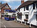
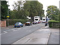
Daily life in B74 2XS benefits from proximity to key retail and transport hubs located within practical reach. Residents have access to five significant retail outlets, including Cook Mere, Aldi Belwell Lane, and Sainsburys Mere, ensuring that grocery shopping and daily essentials are easily accessible. These supermarket chains provide convenience for households that prefer one-stop shopping trips or quick errands closer to home. The area also connects well to the rail network, with five nearby railway stations facilitating journeys to wider destinations. Notable stations include Four Oaks Railway Station, Butlers Lane Railway Station, and Sutton Coldfield Railway Station, offering direct links to Liverpool Street and other major terminals. The transport links simplify commuting for those who work in Birmingham or other parts of the West Midlands without relying solely on cars. The presence of the Royal Hotel historically, built in 1865 to welcome tourists, hints at the town's longstanding role as a destination for visitors and commuters alike. Beyond shopping and transit, the area is close to Sutton Park, a prominent feature derived from an original medieval deer park established for Mercian leaders. King Henry VIII donated his hunting land to the town, creating green space that remains a central part of local recreation. Living in this postcode means having immediate access to both the conveniences of major retailers and the leisure opportunities of a historic royal town, making it a practical choice for families and professionals alike.
Amenities
Schools
| Rank | School | Type | Entry gender | Ages |
|---|
Explore more schools in this area
Go to Schools tabDemographics
The community in B74 2XS is defined by a mature and stable demographic profile. The median age of residents is 47, and adults between the ages of 30 and 64 years form the most common age range within the population. This distribution suggests a neighbourhood where families and established individuals remain long-term residents rather than transient populations. Such an age structure often correlates with higher levels of civic engagement and stability within local communities. The social composition is predominantly White, reflecting the broader character of this established residential zone in the West Midlands. Home ownership stands as a defining feature of this postcode, with 75% of residents owning their homes outright or with a mortgage. This high rate indicates that most inhabitants have bought properties locally and have likely stayed through various market cycles. The predominant accommodation type is houses, meaning families and couples typically live in detached or semi-detached dwellings rather than flats or terraced homes. This housing stock supports the mature age profile, offering space suited to growing children or downsizing retirees. The absence of significant rental market dominance further reinforces the idea that this is a suburb bought and kept by people who intend to make it their permanent home. For anyone considering homes in B74 2XS, the environment reflects a settled lifestyle where residents have invested in the area and shaped the local character over time.
Household Size
Accommodation Type
Tenure
Ethnic Group
Religion
Household Composition
Age
Household Deprivation
NS-SEC
Explore more demographic insights in this area
Go to Demographics tabPlanning
Planning Constraints
- Flood RiskPremium
- Ramsar Wetland SitesPremium
- Area of Outstanding Natural BeautyPremium
- Protected Nature ReservePremium
- Protected WoodlandPremium