Area Overview for B74 2LD
Photos of B74 2LD
Area Information
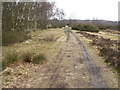
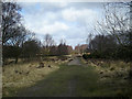
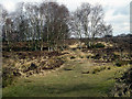
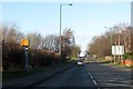
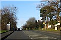
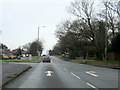
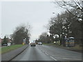
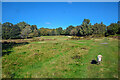
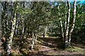
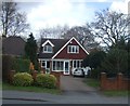
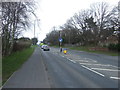
Living in B74 2LD means being part of a small, tightly knit residential cluster in England’s West Midlands, nestled within the broader semi-rural district of Streetly. This postcode area, with a population of 1,471, sits at the edge of Birmingham’s metropolitan sprawl, adjacent to areas like Four Oaks and Great Barr. The district retains a semi-rural character, with open green spaces and proximity to the North Birmingham green belt. Despite its suburban development from the 1960s onwards, the area maintains a quiet, low-density feel, with homes predominantly set in private ownership. Residents benefit from access to Sutton Park, a major local attraction, and historical sites like the Parson & Clerk Inn, which marks the Roman Ryknield Street. The area’s transport links, including nearby rail stations and the M6 motorway, connect it to larger cities while preserving a sense of seclusion. For those seeking a balance between suburban convenience and natural surroundings, B74 2LD offers a distinctive blend of modern housing and historical roots.
- Area Type
- Postcode
- Area Size
- Not available
- Population
- 1471
- Population Density
- 5000 people/km²
The property market in B74 2LD is overwhelmingly owner-occupied, with 91% of homes in private hands. This contrasts sharply with rental-dominated areas, suggesting a stable, long-term resident base. The accommodation type is predominantly houses, reflecting a suburban layout that prioritises space and privacy over high-density living. Given the area’s semi-rural character, these homes are likely to be larger, with gardens, and built from the 1960s onwards. The high home ownership rate indicates limited turnover, which can stabilise property values but may also reduce availability for buyers. For those considering the area, the focus on houses means fewer apartments or flats, appealing to families or individuals seeking traditional housing. The proximity to green belt land and Sutton Park further enhances the appeal of private, spacious homes, aligning with the district’s historical transformation from rural to suburban.
House Prices in B74 2LD
No properties found in this postcode.
Energy Efficiency in B74 2LD
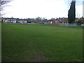
Life in B74 2LD is shaped by its proximity to retail, transport, and green spaces. Within practical reach are shops like Tesco Streetly, Waitrose Little, and Co-op Streetly, offering everyday essentials. Rail and metro stations, including Butlers Lane and Sutton Coldfield, provide easy access to urban centres, while the M6 motorway ensures efficient road travel. The area’s defining feature is Sutton Park, with a dedicated gate in Streetly offering residents direct access to walking and cycling trails. Historical sites like the Parson & Clerk Inn and St. Anne’s Roman Catholic Church add cultural depth. The semi-rural setting means a slower pace of life, with open spaces and nearby farms, yet the area remains well-connected to amenities. This balance of convenience and tranquillity supports a lifestyle that values both community and natural surroundings.
Amenities
Schools
| Rank | School | Type | Entry gender | Ages |
|---|
Explore more schools in this area
Go to Schools tabDemographics
The community in B74 2LD is predominantly composed of adults aged 30–64, with a median age of 47. This suggests a mature, stable population, likely with established careers and families. Home ownership is exceptionally high at 91%, indicating a strong preference for private property over rental housing. The area is characterised by houses rather than flats, reflecting a suburban, family-oriented demographic. The predominant ethnic group is White, though no further diversity data is available. With a population of 1,471 in this specific postcode, the community is small but cohesive. The age profile suggests a low proportion of young families or retirees, which may influence local amenities and services. The high home ownership rate implies a long-term commitment to the area, potentially contributing to a sense of continuity and community identity.
Household Size
Accommodation Type
Tenure
Ethnic Group
Religion
Household Composition
Age
Household Deprivation
NS-SEC
Explore more demographic insights in this area
Go to Demographics tabPlanning
Planning Constraints
- Flood RiskPremium
- Ramsar Wetland SitesPremium
- Area of Outstanding Natural BeautyPremium
- Protected Nature ReservePremium
- Protected WoodlandPremium