Area Overview for B74 2JJ
Photos of B74 2JJ


Area Information
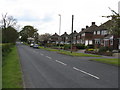
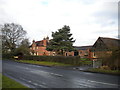
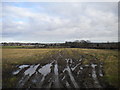
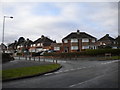
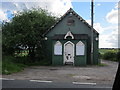
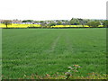
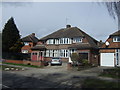
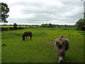
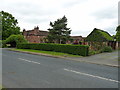
B74 2JJ represents a specific residential cluster situated within the broader suburban district of Streetly. This postcode covers an area of 7,357 square metres and serves a population of 1,863 people. The location sits within the northern part of the Birmingham metropolitan area, adjacent to New Oscott, Great Barr, and Four Oaks. Historically, the region transformed from a sparsely populated rural locale into a residential suburb following mass housing construction in the 1960s and 1970s. While the Midland Railway Company opened Streetly Station in 1879, modern residents access the M6 motorway at Great Barr for primary transport links. Living in B74 2JJ means residing in a district that retains a semi-rural character despite its status as a modern housing estate. The area includes access to Sutton Park, which features a dedicated gate for local entry. You are surrounded by open fields and green belt land that separates the neighbourhood from Walsall. Today, the community benefits from proximity to historical landmarks such as the church built in Foley Road in 1908 and the Parson & Clerk Inn. This postcode offers a established residential environment where historical roots meet contemporary suburban living.
- Area Type
- Postcode
- Area Size
- 7357 m²
- Population
- 1863
- Population Density
- 5697 people/km²
Homes in B74 2JJ consist primarily of houses, reflecting the area's evolution from farmland to a planned residential suburb. The high level of home ownership, currently at 89%, signifies that most residents have purchased their properties outright or have significant equity. This contrasts sharply with areas dominated by private rental sectors. The postcode covers a small residential cluster of 7,357 square metres populated by 1,863 people, suggesting a relatively low density of housing units within this specific boundary. Because housing loans and maintenance costs are the primary expenses for this group, buyers here typically focus on ownership affordability rather than rental yields. The accommodation stock dates largely from the 1960s onwards, representing the wave of post-war suburban expansion that transformed Streetly. Prospective buyers should expect a market geared toward families who have stayed in the area for an extended period. The dominance of houses rather than flats or apartments reinforces the character of a traditional family neighbourhood. When considering homes in B74 2JJ, you are entering a market defined by stability, private ownership, and substantial brick-built housing.
House Prices in B74 2JJ
Showing 12 properties
| Address | Type | Beds | Baths | Last Sale Price | Last Sale Date | |
|---|---|---|---|---|---|---|
| 4 Valentine Close, Streetly, B74 2JJ | Terraced | 3 | 1 | £299,600 | Jun 2025 | |
| 10 Valentine Close, Streetly, B74 2JJ | Terraced | 3 | 1 | £322,500 | Dec 2023 | |
| 8 Valentine Close, Streetly, B74 2JJ | Terraced | 3 | - | £240,000 | Mar 2022 | |
| 5 Valentine Close, Streetly, B74 2JJ | Terraced | 3 | - | £222,000 | Mar 2020 | |
| 7 Valentine Close, Streetly, B74 2JJ | house | - | - | £200,000 | Aug 2019 | |
| 2 Valentine Close, Streetly, B74 2JJ | Terraced | 3 | 1 | £238,000 | Apr 2017 | |
| 9 Valentine Close, Streetly, B74 2JJ | Terraced | - | - | £164,000 | May 2008 | |
| 3 Valentine Close, Streetly, B74 2JJ | Terraced | 3 | - | - | - | |
| 1 Valentine Close, Streetly, B74 2JJ | Terraced | - | - | - | - | |
| 6 Valentine Close, Streetly, B74 2JJ | Terraced | - | - | - | - |
Energy Efficiency in B74 2JJ
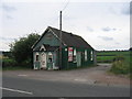
Your daily routine in B74 2JJ benefits from a selection of amenities located within practical reach. For shopping needs, you can access five retail venues, including Waitrose Little, Tesco Streetly, and Morrisons Daily Great Barr 921. These options provide comprehensive grocers and essential goods without requiring a long journey. Five rail stations serve the wider region, with Four Oaks Railway Station, Butlers Lane Railway Station, and Sutton Coldfield Railway Station offering connections beyond the local cluster. Beyond trains, five metro hubs are nearby, including Soho Benson Road, Winson Green Outer Circle, and Handsworth Booth Street. Residents also enjoy proximity to Sutton Park, which offers a dedicated gate for local entry. The park houses historical landmarks such as the Parson & Clerk Inn, marking the start of the Roman Ryknield Street. Community facilities include a clinic and library located in Blackwood Road. These structures date from the 1960–1970 period and serve the immediate neighbourhood. Living in B74 2JJ provides convenient access to supermarkets, leisure, and transport while maintaining a semi-rural feel surrounded by farms and green belt land.
Amenities
Schools
| Rank | School | Type | Entry gender | Ages |
|---|
Explore more schools in this area
Go to Schools tabDemographics
The community within the B74 2JJ postcode is defined by a mature demographic profile with a median age of 47 years. The most common age range among residents consists of adults between 30 and 64 years old. This age distribution suggests a neighbourhood settled by families and older professionals rather than students or young singles. Home ownership stands at 89%, indicating that the vast majority of households buy their properties rather than rent. The predominant accommodation type comprises houses, which aligns with the high level of private ownership. Census data reveals that the predominant ethnic group is White. These demographic patterns reflect a traditional suburban model where long-term families have established roots over decades. The high ownership rate of 89% implies significant stability within the local community. With fewer young people and a strong focus on homeownership, daily life likely centres on family activities and local governance. The lack of rental dependency often correlates with greater investment in property maintenance and community engagement. This demographic stability means the area attracts buyers seeking established neighbourhoods with clear ownership structures.
Household Size
Accommodation Type
Tenure
Ethnic Group
Religion
Household Composition
Age
Household Deprivation
NS-SEC
Explore more demographic insights in this area
Go to Demographics tabPlanning
Planning Constraints
- Flood RiskPremium
- Ramsar Wetland SitesPremium
- Area of Outstanding Natural BeautyPremium
- Protected Nature ReservePremium
- Protected WoodlandPremium