Area Overview for B74 2DN
Photos of B74 2DN
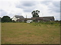
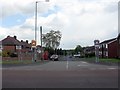
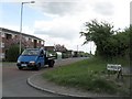

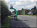
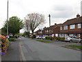

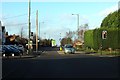

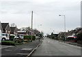
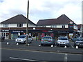
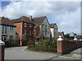
16 photos from this area
Area Information
Key information about the B74 2DN including its size, population, and administrative classification.
- Area Type
- Postcode
- Area Size
- 5275 m²
- Population
- 1471
- Population Density
- 5000 people/km²
House Prices in B74 2DN
14
Properties
£146,268
Average Sold Price
£51,500
Lowest Price
£250,000
Highest Price
Showing 14 properties
| Address | Type | Beds | Baths | Last Sale Price | Last Sale Date | |
|---|---|---|---|---|---|---|
| 9 Magnum Close, Streetly, B74 2DN | house | 2 | 1 | £250,000 | Sep 2023 | |
| 12 Magnum Close, Streetly, B74 2DN | house | 2 | - | £245,000 | Sep 2022 | |
| 14 Magnum Close, Streetly, B74 2DN | Terraced | 2 | - | £176,000 | Jun 2019 | |
| 2 Magnum Close, Streetly, B74 2DN | house | - | - | £142,950 | Nov 2012 | |
| 5 Magnum Close, Streetly, B74 2DN | house | 2 | - | £141,000 | Aug 2010 | |
| 16 Magnum Close, Streetly, B74 2DN | house | 2 | - | £146,500 | May 2010 | |
| 1 Magnum Close, Streetly, B74 2DN | Semi-detached | - | - | £167,000 | Dec 2006 | |
| 10 Magnum Close, Streetly, B74 2DN | Semi-detached | - | - | £119,000 | Jun 2003 | |
| 11 Magnum Close, Streetly, B74 2DN | house | 2 | 1 | £112,995 | Nov 2002 | |
| 8 Magnum Close, Streetly, B74 2DN | house | 2 | 1 | £51,500 | Nov 1999 |
Page 1 of 2
Energy Efficiency in B74 2DN
Amenities
Schools
| Rank | School | Type | Entry gender | Ages |
|---|
Explore more schools in this area
Go to Schools tabDemographics
Household Size
Family (3-5 people)
most common
Accommodation Type
Houses
most common
Tenure
91
majority
Ethnic Group
White
most common
Religion
N/A
most common
Household Composition
N/A
most common
Age
47
median
Adults (30-64 years)
most common
Household Deprivation
N/A
with no deprivation
NS-SEC
37
in Lower managerial occupations
Explore more demographic insights in this area
Go to Demographics tabPlanning
Planning Constraints
- Flood RiskPremium
- Ramsar Wetland SitesPremium
- Area of Outstanding Natural BeautyPremium
- Protected Nature ReservePremium
- Protected WoodlandPremium