Area Overview for B74 2AL
Photos of B74 2AL
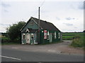
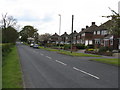
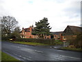
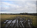
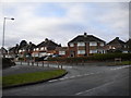
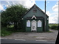
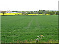
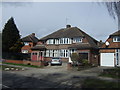
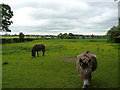
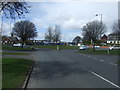

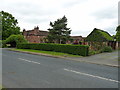
14 photos from this area
Area Information
Key information about the B74 2AL including its size, population, and administrative classification.
- Area Type
- Postcode
- Area Size
- 1.9 hectares
- Population
- 1411
- Population Density
- 3340 people/km²
House Prices in B74 2AL
28
Properties
£161,617
Average Sold Price
£73,500
Lowest Price
£250,000
Highest Price
Showing 28 properties
| Address | Type | Beds | Baths | Last Sale Price | Last Sale Date | |
|---|---|---|---|---|---|---|
| 179 Queslett Road East, Oscott, Birmingham, B74 2AL | Maisonette | 1 | 1 | £115,000 | Mar 2024 | |
| 187 Queslett Road East, Oscott, Birmingham, B74 2AL | Flat | 1 | 1 | £105,000 | Mar 2020 | |
| 173 Queslett Road East, Oscott, Birmingham, B74 2AL | Maisonette | 1 | 1 | £105,000 | Oct 2014 | |
| 149 Queslett Road East, Sutton Vesey, Sutton Coldfield, B74 2AL | house | 3 | - | £188,500 | Feb 2012 | |
| 163 Queslett Road East, Sutton Vesey, Sutton Coldfield, B74 2AL | house | 3 | - | £235,000 | Sep 2011 | |
| 157 Queslett Road East, Sutton Vesey, Sutton Coldfield, B74 2AL | Semi-detached | - | - | £217,500 | May 2008 | |
| 141 Queslett Road East, Sutton Vesey, Sutton Coldfield, B74 2AL | house | - | - | £250,000 | Jan 2007 | |
| 159 Queslett Road East, Sutton Vesey, Sutton Coldfield, B74 2AL | Semi-detached | - | - | £249,900 | Jul 2006 | |
| 191 Queslett Road East, Oscott, Birmingham, B74 2AL | Flat | - | - | £73,500 | May 2003 | |
| 145 Queslett Road East, Sutton Vesey, Sutton Coldfield, B74 2AL | house | - | - | £168,000 | Dec 2002 |
Page 1 of 3
Energy Efficiency in B74 2AL
Amenities
Schools
| Rank | School | Type | Entry gender | Ages |
|---|
Explore more schools in this area
Go to Schools tabDemographics
Household Size
Family (3-5 people)
most common
Accommodation Type
Houses
most common
Tenure
93
majority
Ethnic Group
White
most common
Religion
N/A
most common
Household Composition
N/A
most common
Age
47
median
Adults (30-64 years)
most common
Household Deprivation
N/A
with no deprivation
NS-SEC
38
in Lower managerial occupations
Explore more demographic insights in this area
Go to Demographics tabPlanning
Planning Constraints
- Flood RiskPremium
- Ramsar Wetland SitesPremium
- Area of Outstanding Natural BeautyPremium
- Protected Nature ReservePremium
- Protected WoodlandPremium