Area Overview for B73 6US
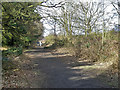
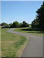
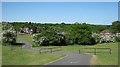
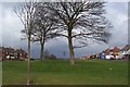
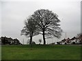
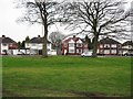
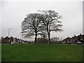
Photos of B73 6US

Area Information
Living in B73 6US means inhabiting a small, tightly knit residential cluster in England’s West Midlands. With a population of 1,434, the area reflects a mature community, where the median age of 47 and a dominant age range of 30–64 years suggest a stable, family-oriented demographic. The high home ownership rate of 92% underscores a preference for long-term residency, with most properties being houses rather than flats. This area benefits from low crime risk, with a safety score of 93 out of 100, and no significant environmental constraints like flood zones or protected natural sites. Daily life is shaped by proximity to essential amenities, including retail outlets like Co-op Kingstanding and Iceland Kingstanding, and transport links such as Wylde Green Railway Station. The area’s historical roots in Sutton Coldfield, a royal town with medieval heritage, add a layer of quiet tradition to its modern practicality. For buyers, B73 6US offers a blend of security, convenience, and a sense of community in a compact, well-served postcode.
- Area Type
- Postcode
- Area Size
- Not available
- Population
- 1434
- Population Density
- 3749 people/km²
The property market in B73 6US is characterised by a high rate of home ownership, with 92% of properties being owner-occupied. This indicates a stable, long-term resident base rather than a rental market. The accommodation type is predominantly houses, which is typical for smaller, residential postcode areas where flats are less common. The limited size of the area means the housing stock is relatively constrained, with fewer options for buyers compared to larger urban centres. For those considering the area, this suggests a focus on family homes with potential for long-term investment. The absence of high-density housing also means the market is unlikely to attract large-scale developers or speculative buyers. Nearby areas may offer more variety, but B73 6US itself is best suited for those prioritising security, stability, and a quiet, established community.
House Prices in B73 6US
No properties found in this postcode.
Energy Efficiency in B73 6US
The lifestyle in B73 6US is shaped by its proximity to practical amenities, including retail options like Co-op Kingstanding, Iceland Kingstanding, and Waitrose Little. These stores offer everyday shopping needs, enhancing convenience for residents. The area’s transport links, such as Wylde Green Railway Station and Sutton Coldfield Railway Station, provide access to broader networks, facilitating travel to nearby towns and cities. While specific parks or leisure facilities are not detailed in the data, the historical context of Sutton Coldfield suggests nearby green spaces, such as Sutton Park, may be accessible. The mix of retail, transport, and educational facilities creates a self-contained environment, ideal for those prioritising ease of access over sprawling urban amenities. Daily life here balances practicality with the quiet charm of a smaller, well-connected community.
Amenities
Schools
The schools near B73 6US include Banners Gate Junior School and Banners Gate Infant and Nursery School, both primary institutions, as well as The Bridge School and Longmoor School and Residential Unit, which are special needs schools. Banners Gate Primary School also serves the area. This mix of school types ensures families have access to both mainstream education and specialist provision for children with additional needs. The presence of multiple primary schools within close proximity suggests a strong local educational infrastructure, reducing the need for long commutes. However, no Ofsted ratings or specific performance data are provided in the data. The availability of special schools highlights the area’s capacity to support diverse family requirements, though parents should investigate individual school profiles for detailed insights.
| Rank | School | Type | Entry gender | Ages |
|---|
Explore more schools in this area
Go to Schools tabDemographics
The community in B73 6US is predominantly composed of adults aged 30–64, with a median age of 47. This suggests a mature, established population, likely with long-term ties to the area. Home ownership is exceptionally high at 92%, indicating a strong preference for owning property over renting. The accommodation type is primarily houses, reflecting a lack of high-density housing typical of smaller, residential clusters. The predominant ethnic group is White, though no specific data on diversity or deprivation is provided. The absence of significant age ranges below 30 or over 65 implies a community focused on middle-aged residents, possibly with families. This demographic profile aligns with a low-risk environment, where stability and long-term residency are prioritised. The high home ownership rate also suggests a lower turnover of residents, contributing to a cohesive, familiar neighbourhood dynamic.
Household Size
Accommodation Type
Tenure
Ethnic Group
Religion
Household Composition
Age
Household Deprivation
NS-SEC
Explore more demographic insights in this area
Go to Demographics tabPlanning
Planning Constraints
- Flood RiskPremium
- Ramsar Wetland SitesPremium
- Area of Outstanding Natural BeautyPremium
- Protected Nature ReservePremium
- Protected WoodlandPremium