Area Overview for B73 6NS
Photos of B73 6NS
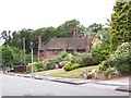
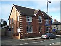
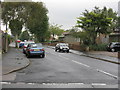
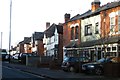
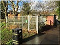
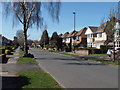
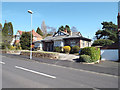
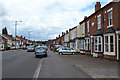
31 photos from this area
Area Information
Key information about the B73 6NS including its size, population, and administrative classification.
- Area Type
- Postcode
- Area Size
- 3.3 hectares
- Population
- 1440
- Population Density
- 4061 people/km²
House Prices in B73 6NS
46
Properties
£297,152
Average Sold Price
£100,000
Lowest Price
£585,750
Highest Price
Showing 46 properties
| Address | Type | Beds | Baths | Last Sale Price | Last Sale Date | |
|---|---|---|---|---|---|---|
| 44 Melrose Avenue, Sutton Vesey, Sutton Coldfield, B73 6NS | Detached | 3 | 2 | £585,750 | Mar 2025 | |
| 36 Melrose Avenue, Sutton Vesey, Sutton Coldfield, B73 6NS | Semi-detached | 3 | 1 | £356,000 | Jun 2024 | |
| 30 Melrose Avenue, Sutton Vesey, Sutton Coldfield, B73 6NS | Semi-detached | 4 | 1 | £480,000 | Mar 2024 | |
| 50 Melrose Avenue, Sutton Vesey, Sutton Coldfield, B73 6NS | Retail | 3 | 1 | £557,000 | Sep 2022 | |
| 70 Melrose Avenue, Sutton Vesey, Sutton Coldfield, B73 6NS | house | - | - | £545,000 | Jun 2021 | |
| 54 Melrose Avenue, Sutton Vesey, Sutton Coldfield, B73 6NS | house | - | - | £477,500 | Feb 2021 | |
| 72 Melrose Avenue, Sutton Vesey, Sutton Coldfield, B73 6NS | Detached | 3 | 1 | £457,500 | Oct 2019 | |
| 42 Melrose Avenue, Sutton Vesey, Sutton Coldfield, B73 6NS | Detached | 3 | - | £405,000 | Jul 2016 | |
| 68 Melrose Avenue, Sutton Vesey, Sutton Coldfield, B73 6NS | house | - | - | £365,000 | Nov 2014 | |
| 74 Melrose Avenue, Sutton Vesey, Sutton Coldfield, B73 6NS | house | - | - | £305,000 | Nov 2013 |
Page 1 of 5
Energy Efficiency in B73 6NS
Amenities
Schools
| Rank | School | Type | Entry gender | Ages |
|---|
Explore more schools in this area
Go to Schools tabDemographics
Household Size
Family (3-5 people)
most common
Accommodation Type
Houses
most common
Tenure
95
majority
Ethnic Group
White
most common
Religion
N/A
most common
Household Composition
N/A
most common
Age
47
median
Adults (30-64 years)
most common
Household Deprivation
N/A
with no deprivation
NS-SEC
53
in Lower managerial occupations
Explore more demographic insights in this area
Go to Demographics tabPlanning
Planning Constraints
- Flood RiskPremium
- Ramsar Wetland SitesPremium
- Area of Outstanding Natural BeautyPremium
- Protected Nature ReservePremium
- Protected WoodlandPremium