Area Overview for B73 6HZ
Photos of B73 6HZ


Area Information
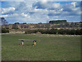
Living in B73 6HZ means being part of a compact, residential postcode area in England with a population of 1,440. This small cluster is nestled in a historically significant region, once a royal town granted a charter by King Henry VIII in 1528. The area’s character is defined by its older housing stock, with 95% of homes owned by residents rather than rented out. Daily life here is shaped by proximity to nearby towns like Sutton Coldfield, which retains medieval features such as Sutton Park, a former royal deer park. The community is predominantly composed of adults aged 30–64, reflecting a mature, settled population. With no major industrial activity today, the area offers a quiet, low-traffic environment. Residents benefit from easy access to rail networks, with stations like Wylde Green and Sutton Coldfield providing connections to Birmingham and beyond. The postcode’s small size means it is tightly integrated with surrounding areas, creating a cohesive local identity. For those seeking a place with historical roots, a sense of community, and practical amenities, B73 6HZ offers a blend of tradition and modern convenience.
- Area Type
- Postcode
- Area Size
- Not available
- Population
- 1440
- Population Density
- 4061 people/km²
The property market in B73 6HZ is dominated by owner-occupied homes, with 95% of properties owned by residents rather than rented. Houses, rather than flats or apartments, make up the majority of the housing stock, reflecting a preference for traditional, standalone dwellings. This suggests a market tailored to families and long-term residents seeking stability, rather than short-term renters. The small size of the postcode area means the housing stock is limited, potentially making the market competitive for buyers. Proximity to rail networks and nearby amenities like retail hubs at M&S Princess Park and Tesco New may enhance property desirability. However, the absence of newer developments or high-density housing indicates a conservative, low-rise character. For buyers, this means opportunities are likely constrained to existing homes, with limited scope for new builds or speculative investment. The high home ownership rate also implies strong community attachment, which can influence property values and local cohesion.
House Prices in B73 6HZ
No properties found in this postcode.
Energy Efficiency in B73 6HZ
Residents of B73 6HZ have access to a range of nearby amenities that support daily life. Retail options include major chains like M&S Princess Park, Tesco New, and Lidl New, ensuring convenience for grocery shopping and everyday needs. The area’s rail and metro stations—Wylde Green, Sutton Coldfield, and Soho Benson Road—provide easy access to public transport, connecting to broader networks. While the data does not specify parks or leisure facilities within the postcode itself, the surrounding region includes historical sites like Sutton Park, a former royal deer park, and Holy Trinity Church, which dates back to the 1300s. The area’s small size means that most amenities are within walking distance or a short drive, fostering a sense of community. The presence of multiple retail outlets and transport links suggests a lifestyle that balances practicality with access to nearby cultural and recreational opportunities. For those valuing convenience and connectivity, B73 6HZ offers a compact, well-served environment.
Amenities
Schools
| Rank | School | Type | Entry gender | Ages |
|---|
Explore more schools in this area
Go to Schools tabDemographics
The population of B73 6HZ is 1,440, with a median age of 47, indicating a mature demographic. The majority of residents fall within the 30–64 age range, suggesting a community of established professionals and families. Home ownership is exceptionally high at 95%, with houses being the predominant type of accommodation. This reflects a stable, long-term resident base rather than a transient rental market. The predominant ethnic group is White, aligning with broader regional trends. The absence of specific data on deprivation or diversity means the area’s social dynamics are not fully detailed, but the high home ownership rate and age profile suggest a low turnover of residents. This demographic profile implies a neighbourhood where community ties are likely strong, with residents prioritising long-term investment in their homes. The lack of younger households or student populations further reinforces the area’s mature, family-oriented character.
Household Size
Accommodation Type
Tenure
Ethnic Group
Religion
Household Composition
Age
Household Deprivation
NS-SEC
Explore more demographic insights in this area
Go to Demographics tabPlanning
Planning Constraints
- Flood RiskPremium
- Ramsar Wetland SitesPremium
- Area of Outstanding Natural BeautyPremium
- Protected Nature ReservePremium
- Protected WoodlandPremium
- Crime RiskPremium