Area Overview for B73 6AU
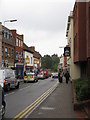
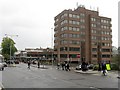
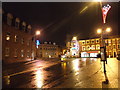
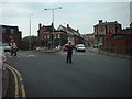
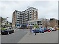
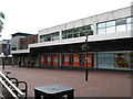
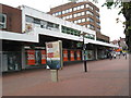
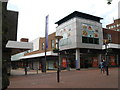
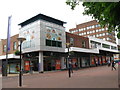
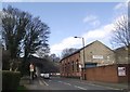
Photos of B73 6AU


Area Information
B73 6AU is a small residential postcode area in England, part of the historically significant town of Sutton Coldfield. With a population of 2157, it reflects the character of a compact, tightly knit community. Sutton Coldfield itself is a royal town with origins dating back to the Bronze Age, later becoming part of Birmingham in 1974. The area’s name derives from *Suþtun* (“south town”) and *Coldfield*, hinting at its medieval past as a hunting ground and charcoal-producing site. Today, B73 6AU sits within a cluster of homes that balance historical heritage with modern living. The area is served by five nearby railway stations, including Sutton Coldfield and Wylde Green, offering easy access to Birmingham and beyond. Locals benefit from proximity to retail hubs like M&S Sutton Coldfield and Tesco Birmingham, ensuring daily convenience. While the population is modest, the area’s blend of residential tranquillity and practical connectivity makes it a viable option for those seeking a manageable, community-focused lifestyle.
- Area Type
- Postcode
- Area Size
- Not available
- Population
- 2157
- Population Density
- 2836 people/km²
The property market in B73 6AU is characterised by a 55% home ownership rate, suggesting a balance between owner-occupied properties and rental units. The predominant accommodation type is flats, which are common in smaller residential clusters like this postcode area. This indicates a housing stock suited to smaller households or those seeking manageable living spaces. The relatively high proportion of flats may reflect a focus on efficiency and affordability, though it also implies limited scope for larger family homes. For buyers, this means the area is more likely to appeal to individuals or couples rather than growing families. The small size of the area and its proximity to nearby amenities such as railway stations and retail centres could enhance its appeal for those prioritising convenience over expansive property options.
House Prices in B73 6AU
No properties found in this postcode.
Energy Efficiency in B73 6AU
Living in B73 6AU provides access to essential amenities within easy reach. The area is served by five railway stations, including Sutton Coldfield and Wylde Green, offering convenient travel options for commuters. Retail choices are diverse, with notable venues such as M&S Sutton Coldfield, Aldi Sutton, and Tesco Birmingham nearby. These stores cater to daily shopping needs, from groceries to general retail. While the data does not specify dining or leisure options, the proximity to major retail hubs suggests a practical, service-oriented lifestyle. The area’s small scale means residents can navigate local facilities on foot or by bike, fostering a sense of community. The presence of historical sites like Sutton Park, though not explicitly detailed in the data, may also contribute to a culturally rich environment, blending practicality with heritage.
Amenities
Schools
| Rank | School | Type | Entry gender | Ages |
|---|
Explore more schools in this area
Go to Schools tabDemographics
The population of B73 6AU is 2157, with a median age of 47 and the majority of residents falling within the 30–64 age range. This suggests a mature, stable community with a focus on established households. Home ownership in the area stands at 55%, indicating a mix of owner-occupied properties and rental units. The predominant accommodation type is flats, reflecting a housing stock tailored to smaller or multi-generational living arrangements. The predominant ethnic group is White, which aligns with broader demographic trends in the region. While no specific deprivation data is provided, the age profile and home ownership rate imply a population with established careers and long-term residency. This demographic structure may influence local amenities and services, which are likely oriented towards the needs of middle-aged adults and families.
Household Size
Accommodation Type
Tenure
Ethnic Group
Religion
Household Composition
Age
Household Deprivation
NS-SEC
Explore more demographic insights in this area
Go to Demographics tabPlanning
Planning Constraints
- Flood RiskPremium
- Ramsar Wetland SitesPremium
- Area of Outstanding Natural BeautyPremium
- Protected Nature ReservePremium
- Protected WoodlandPremium