Area Overview for B73 5RS
Photos of B73 5RS
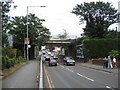
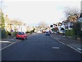

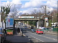
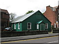

100 photos from this area
Area Information
Key information about the B73 5RS including its size, population, and administrative classification.
- Area Type
- Postcode
- Area Size
- 6768 m²
- Population
- 1591
- Population Density
- 3527 people/km²
House Prices in B73 5RS
17
Properties
£309,238
Average Sold Price
£146,000
Lowest Price
£491,630
Highest Price
Showing 17 properties
| Address | Type | Beds | Baths | Last Sale Price | Last Sale Date | |
|---|---|---|---|---|---|---|
| 4 Buxton Road, Sutton Vesey, Sutton Coldfield, B73 5RS | Semi-detached | 3 | 1 | £425,000 | Mar 2025 | |
| 10 Buxton Road, Sutton Vesey, Sutton Coldfield, B73 5RS | house | 3 | - | £491,630 | Feb 2023 | |
| 7 Buxton Road, Sutton Vesey, Sutton Coldfield, B73 5RS | house | - | - | £425,000 | Nov 2022 | |
| 5 Buxton Road, Sutton Vesey, Sutton Coldfield, B73 5RS | house | - | - | £345,000 | Aug 2018 | |
| 3 Buxton Road, Sutton Vesey, Sutton Coldfield, B73 5RS | Semi-detached | 3 | - | £380,000 | Oct 2017 | |
| 2A Buxton Road, Sutton Vesey, Sutton Coldfield, B73 5RS | house | - | - | £307,000 | Jan 2014 | |
| 8 Buxton Road, Sutton Vesey, Sutton Coldfield, B73 5RS | house | 3 | - | £188,750 | Feb 2011 | |
| 17 Buxton Road, Sutton Vesey, Sutton Coldfield, B73 5RS | Semi-detached | - | - | £205,000 | Jul 2004 | |
| 12 Buxton Road, Sutton Vesey, Sutton Coldfield, B73 5RS | Terraced | - | - | £179,000 | Jan 2003 | |
| 16 Buxton Road, Sutton Vesey, Sutton Coldfield, B73 5RS | house | - | - | £146,000 | Oct 2001 |
Page 1 of 2
Energy Efficiency in B73 5RS
Amenities
Schools
| Rank | School | Type | Entry gender | Ages |
|---|
Explore more schools in this area
Go to Schools tabDemographics
Household Size
Family (3-5 people)
most common
Accommodation Type
Houses
most common
Tenure
85
majority
Ethnic Group
White
most common
Religion
N/A
most common
Household Composition
N/A
most common
Age
47
median
Adults (30-64 years)
most common
Household Deprivation
N/A
with no deprivation
NS-SEC
52
in Lower managerial occupations
Explore more demographic insights in this area
Go to Demographics tabPlanning
Planning Constraints
- Flood RiskPremium
- Ramsar Wetland SitesPremium
- Area of Outstanding Natural BeautyPremium
- Protected Nature ReservePremium
- Protected WoodlandPremium