Area Overview for B73 5LT
Photos of B73 5LT


Area Information
Living in B73 5LT offers a distinct experience within the Royal Town of Sutton Coldfield. This specific postcode cluster comprises only 2.4 hectares, yet it houses a population of 1,591 residents. You are situated in a very dense residential environment, with a population density reaching 65,835 people per square kilometre. This illustrates a compact, established neighbourhood rather than a sprawling development. The area forms part of Sutton Coldfield, a historic settlement that gained Royal Charter in 1528 and became part of Birmingham in 1974. The high density suggests a well-developed community where daily needs are likely within walking distance. You enter a locality defined by its proximity to Sutton Park, the largest inner-city park in the UK, and its rich Anglo-Saxon and medieval history. While B73 5LT is a small geographical area, it is embedded in a town with recognised historical significance, including sites like Holy Trinity Church and Bishop Vesey's Grammar School. The combination of urban density and Royal town heritage creates a specific urban living character. You are not in a remote village nor in a modern satellite town, but in a compact, mature slice of a established metropolitan area. The small footprint means the layout is likely consistent, with homes positioned close together to maximise the available space.
- Area Type
- Postcode
- Area Size
- 2.4 hectares
- Population
- 1591
- Population Density
- 3527 people/km²
The property market in B73 5LT is fundamentally shaped by the predominance of owner-occupied housing. With 85 per cent of homes owned by residents, this is clearly a buyer's market rather than a landlord's playground. The accommodation type listed as houses reinforces the likelihood that you are looking for detached or semi-detached properties typical of a town setting. This high ownership rate means property values here are driven by family needs and long-term living plans rather than speculative rental yields. Buyers should expect the local estate to be well-kept, as owners often take greater pride in maintaining their own homes. The area size of 2.4 hectares indicates a small, focused residential cluster, which often supports stable property prices due to limited space for new developments. The median age of 47 further suggests demand from families or empty nesters who value space and community over urban chic. Because there are few rental properties, you cannot find a property here to buy and let out immediately. You will be purchasing with the intention of living there. This reduces pressure from short-term market fluctuations or landlord exit strategies. The mix of housing remains consistent with the surrounding Sutton Coldfield estate, offering established standards of construction and layout. Buyers seeking secure, long-term homes in a low-density feel will find this postcode advantageous.
House Prices in B73 5LT
Showing 40 properties
| Address | Type | Beds | Baths | Last Sale Price | Last Sale Date | |
|---|---|---|---|---|---|---|
| 138 Green Lanes, Sutton Coldfield, B73 5LT | Semi-detached | 3 | 1 | £340,000 | Jan 2025 | |
| 141 Green Lanes, Sutton Coldfield, B73 5LT | Detached | 3 | 1 | £415,000 | Sep 2023 | |
| 160 Green Lanes, Sutton Coldfield, B73 5LT | house | - | - | £490,000 | Oct 2022 | |
| 146 Green Lanes, Sutton Coldfield, B73 5LT | Retail | 4 | 1 | £595,000 | May 2022 | |
| 133 Green Lanes, Sutton Coldfield, B73 5LT | house | - | - | £475,000 | Dec 2021 | |
| 139 Green Lanes, Sutton Coldfield, B73 5LT | Detached | 5 | 2 | £492,000 | Apr 2021 | |
| 151 Green Lanes, Sutton Coldfield, B73 5LT | house | - | - | £530,000 | Feb 2020 | |
| 131 Green Lanes, Sutton Coldfield, B73 5LT | Detached | 4 | 3 | £440,000 | Dec 2017 | |
| 147 Green Lanes, Sutton Coldfield, B73 5LT | house | - | - | £395,000 | Mar 2017 | |
| 140 Green Lanes, Sutton Coldfield, B73 5LT | house | - | - | £355,000 | Mar 2017 |
Energy Efficiency in B73 5LT
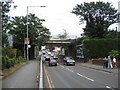
Residents of B73 5LT enjoy immediate access to a range of retail and leisure facilities. Within practical reach, you can visit Sainsburys Wylde for weekly shopping and perishables. Convenience is further enhanced by M&S Penns Lane BP for top-up groceries and Co-op Sutton for financial services and essentials. For those who prefer fresh produce, these supermarkets provide daily necessities close to home. Cultural and transport links are also nearby. You can access St Paul's, St Chads, and Bull Street stations, which serve the broader Sutton Coldfield network. These stops offer connections to Birmingham city centre and other parts of the Black Country and West Midlands. The proximity of these amenities means you do not need long daily commutes for basic needs. This reduces your reliance on a car for every journey. The area benefits from being embedded in a historic town with a status as a Royal Town since the 16th century. This heritage adds cultural depth to your local lifestyle, even if the immediate postcode is residential. You combine the convenience of modern retail with the historical stability of a long-established community. The presence of multiple railway stations nearby ensures you are never stranded if public transport is your primary mode. Shopping, banking, and travel are all integrated into a short walk or cycle from B73 5LT.
Amenities
Schools
| Rank | School | Type | Entry gender | Ages |
|---|
Explore more schools in this area
Go to Schools tabDemographics
The community in B73 5LT is characterised by a mature population and strong homeownership. The median age here is 47 years, indicating that the most common residents are adults between 30 and 64 years old. This age profile suggests a family-oriented area where residents are likely established in their careers and local knowledge of the town is deep. Home ownership stands at 85 per cent, which is exceptionally high. This statistic confirms that the vast majority of people living in B73 5LT own their homes outright or have a significant stake in them. You will find very few rental properties in this specific cluster. The predominant accommodation type is houses, fitting the description of a traditional residential cluster rather than a block of flats. This contrasts with inner-city *postcode* areas which often feature high-rise apartments. The predominant ethnic group is White, reflecting a community with deep local roots. This demographic stability contributes to a settled atmosphere. With high ownership and an older median age, the neighbourhood likely feels quiet and orderly. There is little turnover of residents, meaning neighbours know one another over many years. The combination of high home ownership and a mature age range points to a desirable location for those seeking stability over investment opportunities.
Household Size
Accommodation Type
Tenure
Ethnic Group
Religion
Household Composition
Age
Household Deprivation
NS-SEC
Explore more demographic insights in this area
Go to Demographics tabPlanning
Planning Constraints
- Flood RiskPremium
- Ramsar Wetland SitesPremium
- Area of Outstanding Natural BeautyPremium
- Protected Nature ReservePremium
- Protected WoodlandPremium