Area Overview for B73 5JT
Photos of B73 5JT


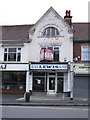


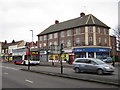
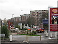
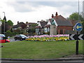
100 photos from this area
Area Information
Key information about the B73 5JT including its size, population, and administrative classification.
- Area Type
- Postcode
- Area Size
- 1.4 hectares
- Population
- 1585
- Population Density
- 5785 people/km²
House Prices in B73 5JT
33
Properties
£214,921
Average Sold Price
£56,000
Lowest Price
£352,000
Highest Price
Showing 33 properties
| Address | Type | Beds | Baths | Last Sale Price | Last Sale Date | |
|---|---|---|---|---|---|---|
| 2 Knipersley Road, Sutton Coldfield, B73 5JT | Semi-detached | 3 | 2 | £325,000 | Aug 2025 | |
| 28 Knipersley Road, Sutton Coldfield, B73 5JT | house | - | - | £342,500 | Dec 2024 | |
| 27 Knipersley Road, Sutton Coldfield, B73 5JT | Semi-detached | 3 | 1 | £260,000 | Dec 2023 | |
| 32 Knipersley Road, Sutton Coldfield, B73 5JT | house | - | - | £352,000 | Dec 2022 | |
| 29 Knipersley Road, Sutton Coldfield, B73 5JT | house | - | - | £308,000 | Nov 2021 | |
| 21 Knipersley Road, Sutton Coldfield, B73 5JT | Semi-detached | 3 | 2 | £180,500 | Aug 2020 | |
| 17 Knipersley Road, Sutton Coldfield, B73 5JT | Semi-detached | 3 | 1 | £270,000 | Sep 2019 | |
| 5 Knipersley Road, Sutton Coldfield, B73 5JT | Semi-detached | 3 | 1 | £269,000 | Aug 2019 | |
| 4 Knipersley Road, Sutton Coldfield, B73 5JT | house | - | - | £266,000 | Jan 2019 | |
| 25 Knipersley Road, Sutton Coldfield, B73 5JT | house | - | - | £218,500 | Apr 2018 |
Page 1 of 4
Energy Efficiency in B73 5JT
Amenities
Schools
| Rank | School | Type | Entry gender | Ages |
|---|
Explore more schools in this area
Go to Schools tabDemographics
Household Size
One person
most common
Accommodation Type
Houses
most common
Tenure
57
majority
Ethnic Group
White
most common
Religion
N/A
most common
Household Composition
N/A
most common
Age
47
median
Adults (30-64 years)
most common
Household Deprivation
N/A
with no deprivation
NS-SEC
33
in Lower managerial occupations
Explore more demographic insights in this area
Go to Demographics tabPlanning
Planning Constraints
- Flood RiskPremium
- Ramsar Wetland SitesPremium
- Area of Outstanding Natural BeautyPremium
- Protected Nature ReservePremium
- Protected WoodlandPremium