Area Overview for B72 1YR
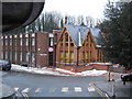
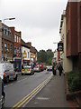
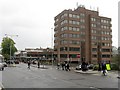
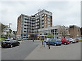
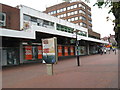
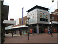
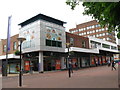
Photos of B72 1YR


Area Information
Living in B72 1YR means being part of a small, tightly knit residential cluster in Sutton Coldfield, a royal town with a population of 2157. This area sits within a historically significant region, once a medieval deer park for Mercian leaders and later a hub of industrial activity. Its proximity to Sutton Park, a preserved medieval landscape, offers residents easy access to open green space, while the conservation area along the High Street hints at centuries of architectural heritage. The area’s compact size means amenities are within practical reach, with rail links to Sutton Coldfield Town and Wylde Green stations providing swift connections to Birmingham and beyond. Daily life here balances quiet residential charm with the convenience of nearby retail, including Aldi Sutton and Tesco Birmingham. With a median age of 47, the community is predominantly composed of adults in their 30s to 60s, many of whom own their homes in flats. The area’s small footprint ensures a sense of familiarity, though buyers should consider its limited size when evaluating long-term needs.
- Area Type
- Postcode
- Area Size
- Not available
- Population
- 2157
- Population Density
- 2836 people/km²
The property market in B72 1YR is defined by a 55% home ownership rate, with flats making up the majority of accommodation types. This suggests a housing stock skewed towards smaller, purpose-built units, often found in residential clusters like this postcode. The relatively low proportion of owner-occupied homes indicates a significant rental market, which may affect property values and availability for buyers. Flats in this area are likely to be part of larger developments or converted buildings, offering practical living spaces for individuals or couples. Given the postcode’s small size, the immediate surroundings may offer limited options for expansion or alternative housing styles. Buyers should consider the compact nature of the area when evaluating long-term suitability, as the density of flats may mean fewer opportunities for larger homes or garden spaces. The market’s character is shaped by its historical context, with properties potentially reflecting the town’s 16th-century origins or later industrial-era construction.
House Prices in B72 1YR
No properties found in this postcode.
Energy Efficiency in B72 1YR
Residents of B72 1YR have access to a range of amenities within walking or short driving distance. Retail options include Aldi Sutton, M&S Sutton Coldfield, and Tesco Birmingham, catering to everyday shopping needs. The area’s rail stations—Sutton Coldfield Town, Wylde Green, and Four Oaks—provide easy access to broader networks, while the St Paul’s metro station enhances connectivity. Nearby, Sutton Park offers a preserved medieval landscape for recreation, with its origins as a royal deer park still evident. The High Street conservation area adds historical charm, and landmarks like Holy Trinity Church and Bishop Vesey’s Grammar School reflect the town’s heritage. The presence of multiple retail outlets and transport links ensures a convenient lifestyle, blending practicality with access to green spaces. While the area’s compact nature limits sprawling developments, its proximity to Sutton Coldfield’s amenities means residents can enjoy both quiet living and urban convenience.
Amenities
Schools
| Rank | School | Type | Entry gender | Ages |
|---|
Explore more schools in this area
Go to Schools tabDemographics
The population of B72 1YR is 2157, with a median age of 47 and the majority of residents falling within the 30–64 age range. Home ownership stands at 55%, indicating a mix of owner-occupied properties and rental units. The accommodation type is predominantly flats, reflecting a housing stock tailored to smaller households or those prioritising convenience over larger living spaces. The predominant ethnic group is White, though specific data on diversity beyond this category is not provided. This age profile suggests a community of established professionals and families, with fewer young adults or retirees. The 55% home ownership rate implies that nearly half of residents rent, which may influence local property dynamics. The absence of detailed deprivation data means quality of life factors like access to services or employment opportunities are not quantified here, but the area’s proximity to retail and transport suggests adequate provision for daily needs.
Household Size
Accommodation Type
Tenure
Ethnic Group
Religion
Household Composition
Age
Household Deprivation
NS-SEC
Explore more demographic insights in this area
Go to Demographics tabPlanning
Planning Constraints
- Flood RiskPremium
- Ramsar Wetland SitesPremium
- Area of Outstanding Natural BeautyPremium
- Protected Nature ReservePremium
- Protected WoodlandPremium