Area Overview for B72 1YL
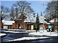
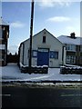
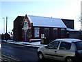
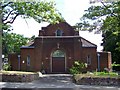
Photos of B72 1YL


Area Information
Living in B72 1YL means being part of a small, tightly knit residential cluster in Sutton Coldfield, a royal town in the West Midlands. With a population of 1,583, the area is compact, offering a quiet, community-focused lifestyle. Sutton Coldfield’s history as a royal town dates back centuries, with its name reflecting its origins as a “south town” relative to Tamworth. Though it became part of Birmingham in 1974, the area retains its distinct character, shaped by medieval landscapes and historic infrastructure. The postcode’s proximity to amenities like Wylde Green Primary School and multiple rail stations makes it practical for daily life, while its low flood risk and absence of environmental constraints ensure stability. Residents here benefit from a balance of historical heritage and modern convenience, with easy access to retail, transport, and green spaces. The area’s compact size means a strong sense of local identity, where neighbours are likely to know each other, and community ties are evident in the mix of shops and transport links nearby.
- Area Type
- Postcode
- Area Size
- Not available
- Population
- 1583
- Population Density
- 4742 people/km²
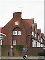
The property market in B72 1YL is characterised by a high rate of home ownership (60%) and a predominance of houses. This suggests a market skewed towards owner-occupied properties rather than rentals, with limited availability of flats or apartments. The focus on houses indicates a demand for family-friendly housing, likely catering to the area’s adult demographic. Given the postcode’s small size, the housing stock is likely limited, making it a niche market for buyers seeking established properties. The absence of significant planning constraints, such as protected woodlands or AONB designations, means development pressure is low, preserving the existing character of the area. For buyers, this means a focus on individual homes rather than larger-scale investment opportunities, with potential for long-term value retention due to the area’s stability and low environmental risks.
House Prices in B72 1YL
No properties found in this postcode.
Energy Efficiency in B72 1YL
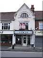
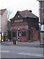
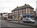
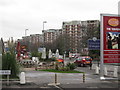
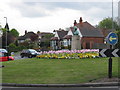
The lifestyle in B72 1YL is shaped by its proximity to practical amenities, including retail outlets like Co-op Sutton, Tesco Erdington, and Sainsburys Wylde. These shops provide everyday convenience, from groceries to household essentials. The area’s rail and metro stations—Chester Road, Erdington, and Wylde Green—offer direct links to Birmingham and beyond, facilitating both commuting and leisure travel. For leisure, the nearby Sutton Park, part of the original medieval deer park, provides green space for walking, cycling, or relaxation. The Royal Hotel, built in 1865, adds a touch of historical charm. The mix of retail, transport, and open spaces creates a balanced environment where residents can enjoy local amenities while maintaining easy access to larger urban centres.
Amenities
Schools
The nearest school to B72 1YL is Wylde Green Primary School, which serves the local community with a primary education offering. It holds a ‘good’ Ofsted rating, indicating a satisfactory standard of teaching and facilities. The presence of a single primary school suggests that families in the area rely on this institution for early education, though no secondary schools are listed in the data. The school’s rating implies that parents can expect a reliable, if not exceptional, educational environment for their children. For families prioritising proximity to schools, Wylde Green Primary School’s location within practical reach of the postcode makes it a key consideration. However, the absence of further educational institutions in the immediate vicinity may require additional travel for secondary schooling.
| Rank | School | Type | Entry gender | Ages |
|---|
Explore more schools in this area
Go to Schools tabDemographics
The community in B72 1YL is predominantly composed of adults aged 30–64, with a median age of 47. This suggests a mature, established population, likely with long-term ties to the area. Home ownership is high at 60%, indicating a stable residential base, while the accommodation type is primarily houses, reflecting a preference for private, family-oriented living. The predominant ethnic group is White, which aligns with broader demographic trends in the region. The absence of specific deprivation data means the area’s quality of life can be inferred from its amenities and safety assessments. The high home ownership rate and age profile suggest a community focused on long-term residency rather than transient populations. However, the lack of diversity data means the full range of cultural or social dynamics here remains unexplored.
Household Size
Accommodation Type
Tenure
Ethnic Group
Religion
Household Composition
Age
Household Deprivation
NS-SEC
Explore more demographic insights in this area
Go to Demographics tabPlanning
Planning Constraints
- Flood RiskPremium
- Ramsar Wetland SitesPremium
- Area of Outstanding Natural BeautyPremium
- Protected Nature ReservePremium
- Protected WoodlandPremium