Area Overview for B72 1XL
Photos of B72 1XL


Area Information
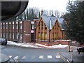
B72 1XL is a small residential postcode area in England, part of the historically significant town of Sutton Coldfield. With a population of 2,157, it reflects the character of a tightly knit community nestled in a region with deep medieval roots. Sutton Coldfield itself is a royal town, granted a charter by King Henry VIII in 1528, and its heritage is woven into the local landscape, from Sutton Park’s medieval deer park to Bishop Vesey’s Grammar School, established in 1527. Daily life in B72 1XL is shaped by its proximity to key amenities, including five nearby railway stations such as Sutton Coldfield and Four Oaks, and retail hubs like M&S Sutton Coldfield and Tesco Birmingham. The area’s compact size means residents have easy access to both local services and the broader West Midlands. While the population is relatively small, the postcode’s connection to Sutton Coldfield’s history and infrastructure ensures a blend of traditional charm and modern convenience. For those considering living here, the mix of historical significance, practical connectivity, and community-focused amenities makes B72 1XL a distinctive choice in a region known for its industrial past and evolving urban landscape.
- Area Type
- Postcode
- Area Size
- Not available
- Population
- 2157
- Population Density
- 2836 people/km²
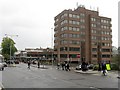
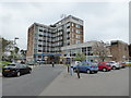
The property market in B72 1XL is defined by a 55% home ownership rate, with flats being the predominant accommodation type. This suggests a housing stock that is largely composed of purpose-built or converted flats, possibly in older residential blocks or purpose-designed developments. The relatively low proportion of owner-occupied homes compared to rentals may indicate a mix of long-term residents and tenants, though the exact balance between these groups is not specified. Given the area’s small size, the available housing stock is likely limited, with buyers needing to consider nearby postcode areas for more options. The prevalence of flats could mean that property sizes are smaller, which may appeal to those prioritising affordability or ease of maintenance. However, the lack of detailed data on property prices, availability, or recent market trends means that buyers should explore adjacent areas for a fuller picture. For those interested in B72 1XL specifically, the focus on flats may align with a demand for compact, urban living close to local amenities and transport links.
House Prices in B72 1XL
No properties found in this postcode.
Energy Efficiency in B72 1XL
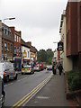
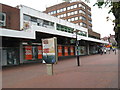
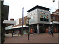
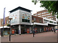
Living in B72 1XL offers access to a range of amenities within practical reach, enhancing daily life for residents. Nearby retail options include M&S Sutton Coldfield, Aldi Sutton, and Tesco Birmingham, providing convenience for grocery shopping and general retail needs. The area’s rail connectivity is a key feature, with five stations—including Sutton Coldfield Railway Station and Wylde Green Railway Station—offering links to broader transport networks. While specific details on dining or leisure venues are not provided, the proximity to Sutton Coldfield suggests access to local pubs, cafes, and community hubs. The town’s historical landmarks, such as Sutton Park and Bishop Vesey’s Grammar School, add cultural and recreational value. The compact nature of the postcode means residents can easily reach these amenities without long commutes. For those prioritising convenience, the combination of retail, rail, and historical sites creates a lifestyle that balances practicality with the charm of a town with medieval heritage.
Amenities
Schools
| Rank | School | Type | Entry gender | Ages |
|---|
Explore more schools in this area
Go to Schools tabDemographics
The population of B72 1XL has a median age of 47, with the majority of residents falling within the 30-64 age range. This suggests a community skewed towards adults, likely including families and professionals. Home ownership is at 55%, indicating a moderate balance between owner-occupied and rental properties. The predominant accommodation type is flats, reflecting a housing stock that may cater to both long-term residents and those seeking more compact living spaces. The predominant ethnic group is White, though specific data on diversity beyond this is not provided. The absence of detailed deprivation metrics means the area’s socioeconomic profile remains partially opaque, but the age distribution and home ownership rate suggest a stable, middle-aged population with established roots. This demographic structure may influence local services and amenities, with a focus on needs such as healthcare, education, and community facilities tailored to adults and families. The area’s small size and specific postcode boundaries mean its social dynamics are likely closely tied to Sutton Coldfield’s broader trends.
Household Size
Accommodation Type
Tenure
Ethnic Group
Religion
Household Composition
Age
Household Deprivation
NS-SEC
Explore more demographic insights in this area
Go to Demographics tabPlanning
Planning Constraints
- Flood RiskPremium
- Ramsar Wetland SitesPremium
- Area of Outstanding Natural BeautyPremium
- Protected Nature ReservePremium
- Protected WoodlandPremium