Area Overview for B72 1UT
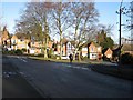
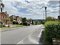
Photos of B72 1UT


Area Information
Living in B72 1UT means being part of a small, tightly knit residential cluster in England’s West Midlands. With a population of 1,819, this postcode area reflects a community rooted in tradition, with historical ties to Sutton Coldfield, a royal town granted a charter by King Henry VIII in 1528. The area’s compact size fosters a sense of familiarity, where local landmarks like Wylde Green Railway Station and Sutton Coldfield Town Station provide easy access to regional transport networks. Daily life here is shaped by proximity to retail hubs such as Tesco Birmingham and Aldi Sutton, alongside the convenience of nearby metro stops at St Paul’s and St Chads. The area’s demographic profile—predominantly adults aged 30–64, with 81% owning their homes—suggests a stable, family-oriented environment. While the postcode covers a limited physical footprint, its strategic location near major rail lines and retail corridors ensures residents enjoy both local charm and connectivity to broader urban amenities.
- Area Type
- Postcode
- Area Size
- Not available
- Population
- 1819
- Population Density
- 3997 people/km²
The property market in B72 1UT is defined by a high rate of home ownership—81% of residents own their homes—suggesting a market dominated by owner-occupied properties rather than rentals. The predominant accommodation type is houses, which aligns with the area’s residential character and likely reflects a demand for family homes or larger living spaces. Given the postcode’s small size, the housing stock is limited, meaning buyers may need to consider nearby areas for more options. The high home ownership rate indicates a stable market with long-term residents, which could reduce turnover and competition. However, the lack of data on property prices or rental availability means potential buyers should investigate local listings and compare with adjacent postcodes. For those seeking a house in this area, the focus is on established properties rather than new developments, offering a blend of traditional architecture and practical living spaces.
House Prices in B72 1UT
No properties found in this postcode.
Energy Efficiency in B72 1UT
Daily life in B72 1UT is shaped by its proximity to essential amenities. Residents have access to retail outlets such as Iceland Sutton, Tesco Birmingham, and Aldi Sutton, ensuring convenience for grocery shopping and everyday needs. The area’s rail network, with stations like Wylde Green and Chester Road, connects residents to broader transport corridors, while metro stops at St Paul’s and St Chads offer additional mobility. Though the data does not specify dining or leisure venues, the presence of multiple retail and transport hubs suggests a practical, service-oriented lifestyle. The compact nature of the postcode means amenities are within walking or short driving distance, fostering a sense of community and reducing reliance on long commutes. This balance of local convenience and regional connectivity makes the area suitable for those prioritising accessibility and practicality.
Amenities
Schools
| Rank | A + A* % | School | Type | Entry gender | Ages |
|---|
Explore more schools in this area
Go to Schools tabDemographics
The population of B72 1UT is characterised by a median age of 47, with 81% of residents falling within the 30–64 age range. This suggests a community skewed towards middle-aged adults, likely including families and professionals. Home ownership is high at 81%, indicating a strong presence of long-term residents and a focus on property stability. The predominant accommodation type is houses, reflecting a preference for private, standalone living spaces. The predominant ethnic group is White, though specific data on diversity or deprivation is not provided. The age profile implies a mature population, which may influence local services and amenities. With no data on income distribution or deprivation levels, it is unclear how economic factors shape the area’s quality of life, but the high home ownership rate and stable age range suggest a relatively settled community.
Household Size
Accommodation Type
Tenure
Ethnic Group
Religion
Household Composition
Age
Household Deprivation
NS-SEC
Explore more demographic insights in this area
Go to Demographics tabPlanning
Planning Constraints
- Flood RiskLocked
- Ramsar Wetland SitesLocked
- Area of Outstanding Natural BeautyLocked
- Protected Nature ReserveLocked
- Protected WoodlandLocked
- Crime RiskLocked