Area Overview for B72 1TA
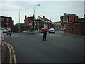
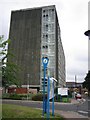
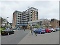
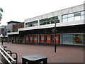
Photos of B72 1TA
Area Information
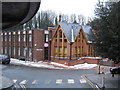
B72 1TA is a specific postcode area covering a small residential cluster within the broader Sutton Coldfield region of the West Midlands. You will find 2,157 residents living across an area of 6,872 square metres, creating a population density of 313,904 people per square kilometre. This figure indicates a highly concentrated settlement where homes stand close together. The location benefits from a deep historical root, as this part of the town became part of Birmingham upon the formation of the metropolitan county in 1974. Despite its rapid modern development, the area retains the character of a royal town, situated near features like Sutton Park which was originally established as a medieval deer park. Living in B72 1TA means residing in an environment where local history intersects with modern urban living. The name Sutton derives from Suþtun, meaning south town, indicating its position relative to Tamworth. Residents benefit from the proximity of landmarks such as Holy Trinity Church, built around 1300, and the conservation area encompassing the High Street. The immediate vicinity offers practical access to major hubs, including Sutton Coldfield Railway Station and various retail locations. This density ensures you are never far from essential services, parks, or transport links, making daily routines convenient for those who work locally or commute to Birmingham.
- Area Type
- Postcode
- Area Size
- 6872 m²
- Population
- 2157
- Population Density
- 2836 people/km²
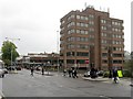
The property market in B72 1TA is characterised by a distinct mix of ownership and housing types. With a home ownership rate of 55%, more than half of the community dwells in properties they own, suggesting a relatively stable market insulated from some volatility of the rental sector. Accommodation in this small cluster is primarily flats, a feature of many high-density developments in modern urban centers. This means buyers looking for detached houses will need to look further afield, as the immediate post-code is dominated by apartment-style living. When considering homes in B72 1TA, you are entering a space designed for vertical living rather than sprawling suburban estates. The high ownership percentage indicates that many residents have secured their tenure, often through buying into these flats during various regeneration phases. This stability can offer peace of mind for new investors or families seeking to settle permanently. Conservation constraints in nearby areas like the High Street influence architectural styles, ensuring that new flats complement the historic character of Sutton Coldfield. Buyers should note that while individual plot options are scarce, the flat layout maximises the use of the limited land area.
House Prices in B72 1TA
Showing 3 properties
| Address | Type | Beds | Baths | Last Sale Price | Last Sale Date | |
|---|---|---|---|---|---|---|
| 1 Trinity Hill, Sutton Coldfield, B72 1TA | Detached | 3 | 2 | £505,000 | Jun 2023 | |
| The Cottage, Trinity Hill, Sutton Coldfield, B72 1TA | Flat | - | - | - | - | |
| The Cottage, Christadelphian Hall, Trinity Hill, Sutton Coldfield, B72 1TA | Flat | - | - | - | - |
Energy Efficiency in B72 1TA
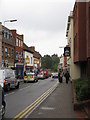
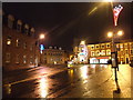
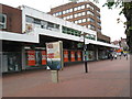
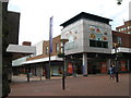
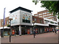
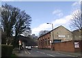
Daily life in B72 1TA is shaped by the convenience of nearby amenities and the historical charm of the surrounding town. Five railway stations are located within practical reach, including Sutton Coldfield Railway Station, Four Oaks Railway Station, and Wylde Green Railway Station, facilitating easy commutes. Shopping is equally accessible, with five notable retail outlets nearby. You can find groceries at M&S Sutton Coldfield, Aldi Sutton, and Tesco Birmingham, alongside other general stores. These shops are scattered across Sutton Coldfield, ensuring you have a variety of options without traveling far. The lifestyle also benefits from the town's rich heritage, featuring landmarks like Sutton Park, which retains its medieval character as a former deer park. Residents can visit Holy Trinity Church, built around 1300, or explore the extant Bishop Vesey's Grammar School. The High Street remains a conservation area, offering a consistent architectural style. For leisure, the Royal Hotel, built in 1865, stands as a historic venue, while nearby mills like Longmoor Pool and Blackroot Pool offer recreational access. This blend of modern convenience and historic depth creates a balanced environment. School children benefit from schools near the area, and families enjoy the close proximity to essential services. Living in B72 1TA connects you to a working-class market town with royal history, where daily life is convenient yet culturally enriched.
Amenities
Schools
| Rank | School | Type | Entry gender | Ages |
|---|
Explore more schools in this area
Go to Schools tabDemographics
The community in B72 1TA is defined by a mature demographic profile with a median age of 47 years. The most common age group consists of adults between 30 and 64 years old, suggesting a population with significant life experience and stability. This age distribution often correlates with established families or individuals in mid-career stages. You will find that 55% of residents own their homes outright or with a mortgage, indicating a strong presence of owner-occupiers rather than a transient rental market. The remaining households likely consist of private landlords or social housing tenants. Accommodation in this postcode is predominantly comprised of flats, reflecting the vertical housing solutions common in high-density zones. The predominant ethnic group is White, though the area remains part of a diverse metropolitan region. These statistics paint a picture of a settled community where long-term residents are the norm. The high density of 313,904 people per square kilometre suggests limited open space, meaning green areas are likely shared resources rather than private backyards. Living in this area means sharing a vibrant, tightly knit neighbourhood with a mix of young families and older professionals. The specific concentration of adults aged 30 to 64 dominates the social fabric, influencing local shops and leisure activities to cater to working-age needs.
Household Size
Accommodation Type
Tenure
Ethnic Group
Religion
Household Composition
Age
Household Deprivation
NS-SEC
Explore more demographic insights in this area
Go to Demographics tabPlanning
Planning Constraints
- Flood RiskPremium
- Ramsar Wetland SitesPremium
- Area of Outstanding Natural BeautyPremium
- Protected Nature ReservePremium
- Protected WoodlandPremium