Area Overview for B72 1LH
Photos of B72 1LH
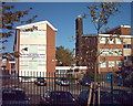
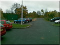
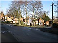
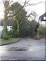
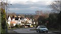
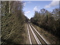
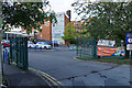
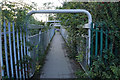
27 photos from this area
Area Information
Key information about the B72 1LH including its size, population, and administrative classification.
- Area Type
- Postcode
- Area Size
- 9628 m²
- Population
- 1506
- Population Density
- 2096 people/km²
House Prices in B72 1LH
12
Properties
£240,000
Average Sold Price
£140,000
Lowest Price
£337,000
Highest Price
Showing 12 properties
| Address | Type | Beds | Baths | Last Sale Price | Last Sale Date | |
|---|---|---|---|---|---|---|
| 104 Pilkington Avenue, Sutton Coldfield, B72 1LH | Bungalow | 4 | - | £325,000 | Aug 2010 | |
| 102 Pilkington Avenue, Sutton Coldfield, B72 1LH | Detached | - | - | £250,000 | Apr 2009 | |
| 129 Pilkington Avenue, Sutton Coldfield, B72 1LH | house | - | - | £337,000 | Jul 2007 | |
| 96 Pilkington Avenue, Sutton Coldfield, B72 1LH | Detached | - | - | £240,000 | May 2003 | |
| 94 Pilkington Avenue, Sutton Coldfield, B72 1LH | Detached | - | - | £148,000 | Nov 1995 | |
| 131 Pilkington Avenue, Sutton Coldfield, B72 1LH | Detached | - | - | £140,000 | Apr 1995 | |
| 139 Pilkington Avenue, Sutton Coldfield, B72 1LH | house | - | - | - | - | |
| 98 Pilkington Avenue, Sutton Coldfield, B72 1LH | Detached | - | - | - | - | |
| 135 Pilkington Avenue, Sutton Coldfield, B72 1LH | Detached | - | - | - | - | |
| 133 Pilkington Avenue, Sutton Coldfield, B72 1LH | house | - | - | - | - |
Page 1 of 2
Energy Efficiency in B72 1LH
Amenities
Schools
| Rank | School | Type | Entry gender | Ages |
|---|
Explore more schools in this area
Go to Schools tabDemographics
Household Size
Two person
most common
Accommodation Type
Houses
most common
Tenure
95
majority
Ethnic Group
White
most common
Religion
N/A
most common
Household Composition
N/A
most common
Age
47
median
Adults (30-64 years)
most common
Household Deprivation
N/A
with no deprivation
NS-SEC
49
in Lower managerial occupations
Explore more demographic insights in this area
Go to Demographics tabPlanning
Planning Constraints
- Flood RiskPremium
- Ramsar Wetland SitesPremium
- Area of Outstanding Natural BeautyPremium
- Protected Nature ReservePremium
- Protected WoodlandPremium