Area Overview for B72 1BS
Photos of B72 1BS
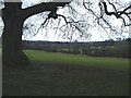
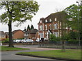
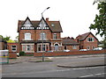
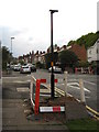
64 photos from this area
Area Information
Key information about the B72 1BS including its size, population, and administrative classification.
- Area Type
- Postcode
- Area Size
- 1.9 hectares
- Population
- 1305
- Population Density
- 2175 people/km²
House Prices in B72 1BS
21
Properties
£269,364
Average Sold Price
£105,000
Lowest Price
£463,000
Highest Price
Showing 21 properties
| Address | Type | Beds | Baths | Last Sale Price | Last Sale Date | |
|---|---|---|---|---|---|---|
| 23 Berwood Road, Sutton Coldfield, B72 1BS | Detached | 4 | - | £346,000 | Jun 2023 | |
| 1 Berwood Road, Sutton Coldfield, B72 1BS | Bungalow | - | - | £463,000 | Dec 2021 | |
| 4 Berwood Road, Sutton Coldfield, B72 1BS | house | 3 | - | £270,000 | May 2015 | |
| 27 Berwood Road, Sutton Coldfield, B72 1BS | Detached | 4 | 2 | £293,500 | Oct 2014 | |
| 19 Berwood Road, Sutton Coldfield, B72 1BS | house | - | - | £291,000 | Sep 2010 | |
| 25 Berwood Road, Sutton Coldfield, B72 1BS | Detached | - | - | £297,500 | Oct 2008 | |
| 1A Berwood Road, Sutton Coldfield, B72 1BS | Bungalow | - | - | £280,000 | Dec 2007 | |
| 10 Berwood Road, Sutton Coldfield, B72 1BS | Detached | 4 | 2 | £277,000 | Sep 2005 | |
| 21 Berwood Road, Sutton Coldfield, B72 1BS | Detached | - | - | £230,000 | Nov 2003 | |
| 7 Berwood Road, Sutton Coldfield, B72 1BS | Detached | 4 | - | £105,000 | Jun 1996 |
Page 1 of 3
Energy Efficiency in B72 1BS
Amenities
Schools
| Rank | School | Type | Entry gender | Ages |
|---|
Explore more schools in this area
Go to Schools tabDemographics
Household Size
Two person
most common
Accommodation Type
Houses
most common
Tenure
93
majority
Ethnic Group
White
most common
Religion
N/A
most common
Household Composition
N/A
most common
Age
47
median
Adults (30-64 years)
most common
Household Deprivation
N/A
with no deprivation
NS-SEC
51
in Lower managerial occupations
Explore more demographic insights in this area
Go to Demographics tabPlanning
Planning Constraints
- Flood RiskPremium
- Ramsar Wetland SitesPremium
- Area of Outstanding Natural BeautyPremium
- Protected Nature ReservePremium
- Protected WoodlandPremium