Area Overview for B71 4NB
Photos of B71 4NB


Area Information
B71 4NB is a compact residential postcode in England, home to 2,943 people. Situated in an area with historical ties to the Black Country’s industrial past, this small cluster of homes reflects a blend of modern living and heritage. The community is predominantly composed of adults aged 30–64, with a median age of 22, suggesting a mix of younger professionals and families. The area’s character is shaped by its proximity to industrial landmarks like the former Chance Brothers Glassworks in Smethwick, though today it offers a quieter, residential atmosphere. Residents benefit from nearby schools, rail links, and retail options, making it practical for daily life. With a population size that fosters a close-knit feel, B71 4NB balances accessibility to urban amenities with a sense of local identity. Its small footprint means every home is within reach of key services, from schools like Galton Valley Primary School to rail stations such as Smethwick Rolfe Street. This postcode is ideal for those seeking a manageable, connected community without the pressures of a larger city.
- Area Type
- Postcode
- Area Size
- Not available
- Population
- 2943
- Population Density
- 4632 people/km²
The property market in B71 4NB is characterised by a 44% home ownership rate, indicating that nearly half of residents rent their homes. This suggests a market where rental demand is significant, possibly due to the area’s proximity to employment hubs or transport links. The accommodation type is predominantly houses, which may appeal to families seeking more space than flats. Given the small size of the postcode, the housing stock is likely limited, with properties concentrated in a compact area. Buyers should consider the local market’s dynamics, as the combination of owner-occupied and rental properties may influence price trends. The presence of schools and transport infrastructure also makes the area attractive to families, though the limited size of the postcode means competition for available homes could be fierce.
House Prices in B71 4NB
No properties found in this postcode.
Energy Efficiency in B71 4NB
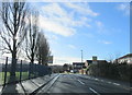
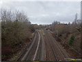
Living in B71 4NB offers a blend of practical amenities and local character. Residents have access to retail options such as Spar, Farmfoods Handsworth, and Lidl Handsworth, providing everyday shopping convenience. The area’s rail and metro stations, including Smethwick Galton Bridge High Level and Winson Green Outer Circle, ensure easy access to nearby towns and cities. While parks and leisure facilities are not explicitly listed, the proximity to historical industrial sites like the Chance Brothers Glassworks hints at a heritage-rich backdrop. The mix of schools, transport, and retail creates a self-contained environment, ideal for those seeking a balance between community and accessibility. The small postcode size means amenities are close, fostering a lifestyle where daily needs are met without long commutes.
Amenities
Schools
Residents of B71 4NB have access to a range of educational institutions, including Edith Sands Nursery School, Brasshouse Infant School, and Albion Junior School, which cater to early years and primary education. Galton Valley Primary School holds an Ofsted rating of ‘good’, offering a reliable option for families. The area also includes The Regis Academy, an independent school, providing a choice for those seeking alternative education models. This mix of state and independent schools reflects a diverse educational landscape, accommodating different preferences and needs. The presence of multiple primary schools within proximity ensures that children have access to schooling without long commutes. For families, this variety supports a balanced approach to education, whether they prioritise public or private institutions.
| Rank | School | Type | Entry gender | Ages |
|---|
Explore more schools in this area
Go to Schools tabDemographics
The population of B71 4NB is 2,943, with a median age of 22, though the most common age group is adults aged 30–64. This suggests a community where families and older residents coexist, with a notable presence of middle-aged professionals. Home ownership stands at 44%, indicating a mix of owner-occupied properties and rental homes. The accommodation type is predominantly houses, which may reflect a preference for family-friendly housing. The area’s predominant ethnic group is Asian_total, contributing to a culturally diverse community. While specific data on deprivation is not provided, the age profile and home ownership figures suggest a stable, working-age population. The presence of schools and transport links further supports a lifestyle that balances domestic life with access to employment and education.
Household Size
Accommodation Type
Tenure
Ethnic Group
Religion
Household Composition
Age
Household Deprivation
NS-SEC
Explore more demographic insights in this area
Go to Demographics tabPlanning
Planning Constraints
- Flood RiskPremium
- Ramsar Wetland SitesPremium
- Area of Outstanding Natural BeautyPremium
- Protected Nature ReservePremium
- Protected WoodlandPremium