Area Overview for B71 4LY
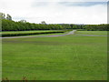
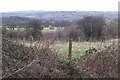
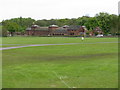
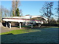
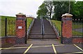
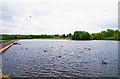
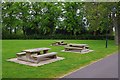
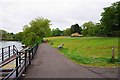
Photos of B71 4LY


Area Information
Living in B71 4LY means being part of a small, tightly knit residential cluster within West Bromwich, a town with deep industrial roots in the West Midlands. The area’s population of 1,756 residents reflects its compact nature, with homes predominantly in the form of houses rather than flats. West Bromwich itself is a town shaped by its history as a coaching road stop in the 18th century and its role in the 19th-century industrial boom. Today, it is served by multiple railway stations, including Smethwick Galton Bridge and Sandwell & Dudley, offering direct links to Birmingham and beyond. The town’s cultural identity is anchored by West Bromwich Albion Football Club, founded in 1878, and its healthcare infrastructure, including Sandwell District General Hospital. Daily life here balances proximity to urban amenities with a quieter residential feel, though the area’s recent past includes challenges such as the 2011 riots. For those seeking a mix of historical character and practical connectivity, B71 4LY offers a distinct slice of West Bromwich’s evolving landscape.
- Area Type
- Postcode
- Area Size
- Not available
- Population
- 1756
- Population Density
- 3161 people/km²
The property market in B71 4LY is defined by a 41% home ownership rate, indicating that nearly half of the area’s homes are owner-occupied, while the remaining properties are likely rented. The accommodation type is predominantly houses, which is typical of West Bromwich’s broader residential fabric. This suggests a focus on single-family homes rather than apartments or flats, which may appeal to families or those seeking more space. Given the area’s small size, the housing stock is limited, and buyers should consider the proximity to nearby towns like Birmingham for additional options. The mix of ownership and rental properties could influence property values, with demand potentially driven by commuters seeking affordable homes near transport links.
House Prices in B71 4LY
No properties found in this postcode.
Energy Efficiency in B71 4LY
Residents of B71 4LY have access to a range of amenities within practical reach. Retail options include Tesco West, Heron West, and M&S Astle, providing everyday shopping needs. The area is served by five metro stops, including West Bromwich Central and Trinity Way, and five railway stations, such as Sandwell & Dudley, making commuting convenient. For leisure, the nearby West Bromwich Albion Football Club offers a focal point for local culture. The town centre’s Ringway circulates main shopping areas, while healthcare facilities like Sandwell District General Hospital are accessible. The mix of retail, transport, and cultural landmarks creates a lifestyle that balances practicality with community engagement, though the area’s small size means amenities are concentrated rather than spread out.
Amenities
Schools
| Rank | School | Type | Entry gender | Ages |
|---|
Explore more schools in this area
Go to Schools tabDemographics
The residents of B71 4LY are predominantly adults aged 30–64, with a median age of 47, reflecting a mature, established community. Home ownership rates here stand at 41%, suggesting a mix of owner-occupied properties and rental homes. The area is characterised by houses rather than flats, aligning with the broader trend in West Bromwich’s Central Ward. The predominant ethnic group is White, though no specific data on diversity beyond this is provided. With 1,756 residents in a small postcode area, the community is likely to be close-knit, with local amenities and transport options serving a relatively limited population. The age profile indicates a stable demographic, which may influence the types of services and facilities prioritised in the area.
Household Size
Accommodation Type
Tenure
Ethnic Group
Religion
Household Composition
Age
Household Deprivation
NS-SEC
Explore more demographic insights in this area
Go to Demographics tabPlanning
Planning Constraints
- Flood RiskPremium
- Ramsar Wetland SitesPremium
- Area of Outstanding Natural BeautyPremium
- Protected Nature ReservePremium
- Protected WoodlandPremium