Area Overview for B71 4LU
Photos of B71 4LU


Area Information
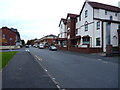
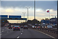
Living in B71 4LU means being part of a small, tightly knit residential cluster in England’s West Midlands, where the population of 2,150 reflects a community rooted in local history. The area’s character is shaped by its proximity to industrial heritage, including sites linked to the Black Country’s 19th-century manufacturing boom. While modern life here is quiet, it is connected to nearby towns through well-established transport networks. The median age of 47 suggests a stable population of adults aged 30–64, many of whom may be long-term residents. The area’s housing stock, dominated by owner-occupied homes, hints at a community prioritising permanence. With no major natural or environmental constraints, B71 4LU offers a straightforward living experience, though its small size means amenities and services are concentrated within a short radius. For those seeking a low-risk, compact environment with practical connectivity, this postcode could be a viable choice.
- Area Type
- Postcode
- Area Size
- Not available
- Population
- 2150
- Population Density
- 2184 people/km²
The property market in B71 4LU is characterised by a 55% home ownership rate, with houses making up the majority of the housing stock. This suggests a community where many residents own their homes, potentially offering stability for buyers. The focus on houses rather than flats or apartments may indicate a preference for family-friendly or more spacious properties. However, the small size of the area means the housing stock is limited, and buyers may need to look beyond the immediate postcode for a broader range of options. The owner-occupied nature of the market could also mean fewer rental properties, which might affect availability for tenants. For those considering purchase, the area’s compact size and historical context could be appealing, though potential buyers should assess whether the existing properties meet their specific needs.
House Prices in B71 4LU
Showing 1 properties
| Address | Type | Beds | Baths | Last Sale Price | Last Sale Date | |
|---|---|---|---|---|---|---|
| Reca-uk Limited, Doranda Way, West Bromwich, B71 4LU | storage_distribution | - | - | - | - |
Energy Efficiency in B71 4LU
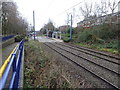
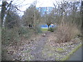
The lifestyle in B71 4LU is shaped by its proximity to retail, transport, and green spaces. Local shops such as Spar, Farmfoods West, and Heron West provide everyday essentials, while nearby metro stops at Kenrick Park and Trinity Way offer easy access to urban hubs. Rail stations like Hawthorns and Smethwick Galton Bridge High Level connect residents to broader networks. Though the area lacks large parks or leisure facilities, its compact nature means amenities are within walking or short driving distance. The presence of multiple schools and specialist services suggests a community focused on family needs. While the area’s small size may limit options for entertainment or dining, its practical connectivity and proximity to transport links make it suitable for those prioritising convenience over expansive leisure opportunities.
Amenities
Schools
Residents of B71 4LU have access to a range of educational institutions, including Leasowes Primary School, West Park College, and Holly Lodge High School College of Science, all of which are rated as primary schools. Holly Lodge High School College of Science holds an Ofsted rating of ‘good’, indicating a reliable standard of education. The area also includes specialist provision through Albert Bradford School, a special needs institution, and Ruskin House Pupil Referral Unit, which serves students with specific educational requirements. While no secondary schools are listed, the presence of multiple primary schools and a specialist provider suggests a focus on early education and tailored support. Families with children may find the mix of school types practical, though they may need to travel further for secondary schooling.
| Rank | School | Type | Entry gender | Ages |
|---|
Explore more schools in this area
Go to Schools tabDemographics
The population of B71 4LU is 2,150, with a median age of 47 and the majority of residents falling within the 30–64 age range. This suggests a mature, established community with fewer young families or retirees compared to other areas. Home ownership rates stand at 55%, indicating a mix of owner-occupied properties and rental units. The accommodation type is predominantly houses, which may appeal to those seeking larger living spaces. The predominant ethnic group is Asian, reflecting a cultural diversity that shapes local traditions and community dynamics. While no specific deprivation data is provided, the age profile and home ownership figures suggest a relatively stable demographic. The absence of significant youth or elderly populations may influence local services and infrastructure needs.
Household Size
Accommodation Type
Tenure
Ethnic Group
Religion
Household Composition
Age
Household Deprivation
NS-SEC
Explore more demographic insights in this area
Go to Demographics tabPlanning
Planning Constraints
- Flood RiskPremium
- Ramsar Wetland SitesPremium
- Area of Outstanding Natural BeautyPremium
- Protected Nature ReservePremium
- Protected WoodlandPremium