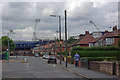
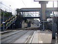
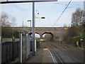
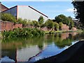
Area Overview for B71 4LH
Photos of B71 4LH


Area Information
B71 4LH represents a specific residential postcode cluster within the greater St. Paul's Ward, covering a landmass of approximately 1,483 square metres. It is a tightly defined area home to a population of 1,481 residents, creating a compact neighbourhood where community dynamics are direct and immediate. This location sits firmly within the West Midlands region, offering a living environment shaped by its proximity to the historic industrial developments of the Black Country. The district carries significant local heritage, linked to the 19th-century industrial expansions that defined Smethwick and the surrounding boroughs. Residents here navigate a setting with deep historical roots, characterised by former manufacturing sites and industrial archaeology. St. Paul's Church, a Grade I listed building constructed in 1779 nearby, anchors the broader cultural landscape with which this small cluster interacts. Life in B71 4LH involves balancing modern conveniences with an area that retains a distinct industrial past. The small physical footprint means that daily routines are often centred on the immediate surroundings, with quick access to essential services and transport links that bridge the gap between this busy postcode and the wider urban rail network. For those considering homes in B71 4LH, the area offers a grounded connection to local history while maintaining functional connectivity to Birmingham and beyond.
- Area Type
- Postcode
- Area Size
- 1483 m²
- Population
- 1481
- Population Density
- 2940 people/km²
The property landscape in B71 4LH is characterised by a distinct lack of high-density housing. All accommodation within this postcode consists of houses, creating a uniform stock that appeals to buyers seeking residential space and gardens rather than urban density. With a home ownership rate of 53%, the market is heavily skewed towards owner-occupiers rather than a high-volume rental sector. This suggests that the houses available for sale are often well-maintained by their owners, potentially leading to better property conditions compared to areas with very low ownership rates. For prospective buyers, this means you are entering a market where investment often yields through direct ownership rather than short-term tenancy turnover. The small total area size of 1,483 square metres limits the volume of properties available at any one time, meaning demand can quickly outstrip supply if multiple homes achieve simultaneous marketing. The exclusively house-based accommodation type also influences local planning and noise levels, fostering a quieter residential atmosphere compared to mixed-use districts. When considering homes in B71 4LH, you should expect a market where established residents dominate, likely resulting in fewer vacant properties and a steady rhythm of transactions. This focus on single-family lodging makes the area particularly attractive to those migrating from city centres in search of standalone living.
House Prices in B71 4LH
Showing 4 properties
| Address | Type | Beds | Baths | Last Sale Price | Last Sale Date | |
|---|---|---|---|---|---|---|
| 4 Albion Road, West Bromwich, B71 4LH | house | - | - | £104,000 | Jan 2007 | |
| 1 Albion Road, West Bromwich, B71 4LH | house | 3 | - | - | - | |
| 2 Albion Road, West Bromwich, B71 4LH | house | - | - | - | - | |
| 3 Albion Road, West Bromwich, B71 4LH | house | - | - | - | - |
Energy Efficiency in B71 4LH
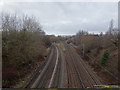
Daily life in B71 4LH is supported by a dense network of amenities within a short travel radius. Residents have access to five railway stations and five metro locations, ensuring steady foot traffic and commercial vitality at these hubs. The town centre offers a variety of retail options, with Spar, Farmfoods Handsworth, and Lidl Handsworth located nearby for weekly grocery shopping. These supermarkets provide comprehensive food provisions, reducing the need for long journeys to larger out-of-town retail parks. Beyond essentials, the area benefits from excellent public transport integration. Five metro stations, including locations like Winson Green Outer Circle, provide rapid city access. The proximity of these rail and metro nodes means you can reach workplaces in Birmingham or Wolverhampton efficiently. Local shops and transport hubs create a dynamic streetscape where residents can meet while running errands. Fuelled by the high population density of 998,480 people per square kilometre, the area maintains a lively local presence. You can rely on predictable operating hours and familiar faces in the local stores. Living in B71 4LH grants you these conveniences without the extended commute times found in spread-out suburbs. The concentration of services here ensures that your weekly routine remains local and efficient.
Amenities
Schools
Family planning for residents of B71 4LH is supported by one major educational facility immediately noted within the vicinity. Sandwell Academy stands as the primary nearby school option. It operates as an academy and holds a "good" Ofsted rating, a designation that signifies adequate standards and a functional learning environment for students. The presence of a school rated "good" provides a reliable option for families without the immediate need to commute further afield for secondary education. While data on primary education institutions is not listed in the available local records, the existing secondary provision suggests that the area has access to approved state education. The academy model of Sandwell Academy implies governance by a charitable trust rather than direct local authority control, which is a common structure for larger secondary institutions in the West Midlands. For parents looking at schools near B71 4LH, this single entry point ensures there is unambiguously rated education nearby. Residents can rely on this institution for a significant portion of their children's secondary schooling requirements. The "good" rating is a concrete indicator of performance that potential homebuyers can use with confidence when evaluating the area for educational quality.
| Rank | School | Type | Entry gender | Ages |
|---|
Explore more schools in this area
Go to Schools tabDemographics
The community profile of B71 4LH is defined by a mature demographic structure. The median age stands at 47 years, reflecting a population dominated by adults aged between 30 and 64 years. This age range suggests a population focused on family stability, retirement planning, and middle-to-late career stages rather than young adults just entering the job market. Over half of the residents, specifically 53%, own their homes outright or with a mortgage, indicating a settled community with strong roots in the neighbourhood. The remaining households likely rely on rentals, but the high ownership rate points to long-term residency and investment in local property values. Accommodation types in B71 4LH are exclusively houses, distinguishing it from areas dominated by high-rise flats or terraced rental stock. This housing style supports the older demographic profile and offers the space typically desired by families in this income bracket. The ethnic composition is predominantly Asian, which shapes the cultural fabric of daily interactions and local commerce within the postcode. Living in B71 4LH means joining a community where residents have likely known their neighbours for many years. The combination of an older population and high home ownership creates an environment where decision-making is often slow and consistent, prioritising stability over rapid change. This social makeup is a consistent feature for anyone viewing homes in this specific location.
Household Size
Accommodation Type
Tenure
Ethnic Group
Religion
Household Composition
Age
Household Deprivation
NS-SEC
Explore more demographic insights in this area
Go to Demographics tabPlanning
Planning Constraints
- Flood RiskPremium
- Ramsar Wetland SitesPremium
- Area of Outstanding Natural BeautyPremium
- Protected Nature ReservePremium
- Protected WoodlandPremium