Area Overview for B71 4JL
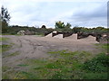
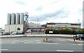
Photos of B71 4JL


Area Information
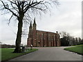
Living in B71 4JL means inhabiting a small, tightly knit residential cluster in England’s West Midlands. With a population of 1,481, the area reflects the region’s industrial heritage, shaped by historical manufacturing sites like the Chance Brothers Glassworks in Smethwick. The community is predominantly composed of adults aged 30–64, with a median age of 47, suggesting a mature, settled demographic. This is a place where houses, not flats, dominate the housing stock, and 53% of residents own their homes. Daily life here is influenced by proximity to rail and metro stations, which connect to broader networks, while local shops and amenities provide essential services. The area’s character is rooted in its past as part of the Black Country’s industrial heartland, with St. Paul’s Church nearby serving as a historical anchor. While modern infrastructure exists, the sense of place is defined by its blend of practical living and historical resonance.
- Area Type
- Postcode
- Area Size
- Not available
- Population
- 1481
- Population Density
- 2940 people/km²
The property market in B71 4JL is characterised by a focus on owner-occupation, with 53% of homes owned by residents. The area is dominated by houses rather than flats or apartments, which is typical of smaller, residential clusters in the West Midlands. This suggests a market that caters to families and individuals seeking stable, long-term housing rather than short-term rental investments. The limited size of the postcode area means the housing stock is relatively uniform, with no indication of high-end properties or luxury developments. For buyers, this presents a straightforward market: properties are likely to be in good condition, with a mix of older and newer builds reflecting the area’s industrial past. However, the small scale of the area may limit availability, requiring buyers to consider nearby postcode zones for more options.
House Prices in B71 4JL
No properties found in this postcode.
Energy Efficiency in B71 4JL
The lifestyle in B71 4JL is shaped by its proximity to essential retail and transport hubs. Local shops include Spar, Farmfoods Handsworth, and Lidl Handsworth, offering everyday groceries and convenience. The rail and metro stations—Hawthorns, Smethwick Galton Bridge, and Smethwick Rolfe Street—provide access to public transport, enabling travel to nearby towns and cities. While the area does not list parks or leisure facilities explicitly, its historical industrial context suggests potential for community spaces repurposed from former manufacturing sites. The availability of retail and transport options supports a practical, commuter-focused lifestyle, with the area’s small size encouraging a walkable, localised approach to daily errands and socialising.
Amenities
Schools
The nearest school to B71 4JL is Sandwell Academy, an academy with a ‘good’ Ofsted rating. This institution serves the local community and is likely a key consideration for families prioritising education quality. The presence of a single academy in the area suggests a reliance on larger, multi-academy trusts to provide a range of educational options. While no other schools are listed, the ‘good’ rating indicates that the school meets national standards in teaching, pupil outcomes, and leadership. For families, this provides a baseline of reliability, though those seeking alternative schooling may need to look further afield. The absence of additional schools highlights the importance of proximity to transport links for accessing broader educational networks.
| Rank | School | Type | Entry gender | Ages |
|---|
Explore more schools in this area
Go to Schools tabDemographics
The community in B71 4JL is predominantly composed of adults aged 30–64, with a median age of 47. This suggests a population that is largely established, with fewer young families or retirees compared to other areas. Home ownership stands at 53%, indicating a mix of owner-occupied properties and rental homes. The accommodation type is primarily houses, which contrasts with areas dominated by flats or apartments. The predominant ethnic group is Asian_total, reflecting the area’s cultural diversity. While no specific deprivation data is provided, the age profile and home ownership rate suggest a stable, middle-aged population with a strong connection to property. The absence of detailed socioeconomic breakdowns means the full picture of quality of life remains partially obscured, but the demographic composition points to a community with a focus on long-term residency and family-oriented living.
Household Size
Accommodation Type
Tenure
Ethnic Group
Religion
Household Composition
Age
Household Deprivation
NS-SEC
Explore more demographic insights in this area
Go to Demographics tabPlanning
Planning Constraints
- Flood RiskPremium
- Ramsar Wetland SitesPremium
- Area of Outstanding Natural BeautyPremium
- Protected Nature ReservePremium
- Protected WoodlandPremium