Area Overview for B71 4DN
Photos of B71 4DN
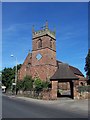
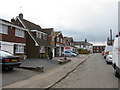
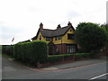
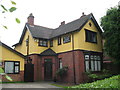

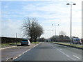
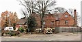
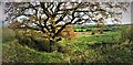
22 photos from this area
Area Information
Key information about the B71 4DN including its size, population, and administrative classification.
- Area Type
- Postcode
- Area Size
- 7384 m²
- Population
- 2393
- Population Density
- 1478 people/km²
House Prices in B71 4DN
25
Properties
£201,500
Average Sold Price
£59,500
Lowest Price
£380,000
Highest Price
Showing 25 properties
| Address | Type | Beds | Baths | Last Sale Price | Last Sale Date | |
|---|---|---|---|---|---|---|
| 1 Vale Street, West Bromwich, B71 4DN | Detached | 4 | 2 | £380,000 | Dec 2023 | |
| 32 Vale Street, West Bromwich, B71 4DN | Semi-detached | 3 | 1 | £245,000 | Jun 2023 | |
| 9 Vale Street, West Bromwich, B71 4DN | house | - | - | £190,000 | Aug 2010 | |
| 10 Vale Street, West Bromwich, B71 4DN | Terraced | - | - | £133,000 | Jul 2007 | |
| 2 Vale Street, West Bromwich, B71 4DN | Terraced | 3 | 1 | £59,500 | Nov 2002 | |
| 12 Vale Street, West Bromwich, B71 4DN | Terraced | 3 | 1 | - | - | |
| 15 Vale Street, West Bromwich, B71 4DN | Detached | 4 | 1 | - | - | |
| Plot 133, Land At Churchfields, All Saints Way, West Bromwich, B71 4DN | undefined | - | - | - | - | |
| Plot 136, Land At Churchfields, All Saints Way, West Bromwich, B71 4DN | undefined | - | - | - | - | |
| 24 Vale Street, West Bromwich, B71 4DN | house | - | - | - | - |
Page 1 of 3
Energy Efficiency in B71 4DN
Amenities
Schools
| Rank | School | Type | Entry gender | Ages |
|---|
Explore more schools in this area
Go to Schools tabDemographics
Household Size
Family (3-5 people)
most common
Accommodation Type
Houses
most common
Tenure
65
majority
Ethnic Group
White
most common
Religion
N/A
most common
Household Composition
N/A
most common
Age
47
median
Adults (30-64 years)
most common
Household Deprivation
N/A
with no deprivation
NS-SEC
26
in Lower managerial occupations
Explore more demographic insights in this area
Go to Demographics tabPlanning
Planning Constraints
- Flood RiskPremium
- Ramsar Wetland SitesPremium
- Area of Outstanding Natural BeautyPremium
- Protected Nature ReservePremium
- Protected WoodlandPremium