Area Overview for B71 4AP
Photos of B71 4AP
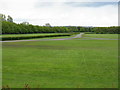
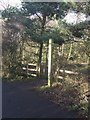
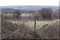
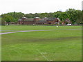
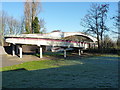
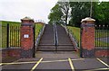
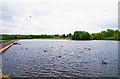
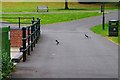
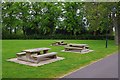
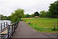
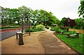

30 photos from this area
Area Information
Key information about the B71 4AP including its size, population, and administrative classification.
- Area Type
- Postcode
- Area Size
- 8009 m²
- Population
- 1756
- Population Density
- 3161 people/km²
House Prices in B71 4AP
21
Properties
£130,900
Average Sold Price
£43,000
Lowest Price
£212,000
Highest Price
Showing 21 properties
| Address | Type | Beds | Baths | Last Sale Price | Last Sale Date | |
|---|---|---|---|---|---|---|
| 64 Woodward Street, West Bromwich, B71 4AP | Terraced | 3 | - | £177,000 | Oct 2021 | |
| 26 Woodward Street, West Bromwich, B71 4AP | Detached | - | - | £212,000 | Oct 2020 | |
| 74 Woodward Street, West Bromwich, B71 4AP | Terraced | 3 | - | £100,000 | Aug 2020 | |
| 36 Woodward Street, West Bromwich, B71 4AP | Semi-detached | 3 | 1 | £75,000 | Sep 2016 | |
| 38 Woodward Street, West Bromwich, B71 4AP | Semi-detached | 3 | 1 | £117,000 | Mar 2016 | |
| 30 Woodward Street, West Bromwich, B71 4AP | Detached | 3 | - | £195,000 | Jan 2015 | |
| 9 Woodward Street, West Bromwich, B71 4AP | Bungalow | - | - | £203,000 | Oct 2011 | |
| 70 Woodward Street, West Bromwich, B71 4AP | Terraced | - | - | £43,000 | Mar 2000 | |
| 3 Woodward Street, West Bromwich, B71 4AP | Detached | - | - | £84,000 | Mar 1999 | |
| 7 Woodward Street, West Bromwich, B71 4AP | Detached | - | - | £103,000 | Mar 1995 |
Page 1 of 3
Energy Efficiency in B71 4AP
Amenities
Schools
| Rank | School | Type | Entry gender | Ages |
|---|
Explore more schools in this area
Go to Schools tabDemographics
Household Size
One person
most common
Accommodation Type
Houses
most common
Tenure
41
majority
Ethnic Group
White
most common
Religion
N/A
most common
Household Composition
N/A
most common
Age
47
median
Adults (30-64 years)
most common
Household Deprivation
N/A
with no deprivation
NS-SEC
18
in Lower managerial occupations
Explore more demographic insights in this area
Go to Demographics tabPlanning
Planning Constraints
- Flood RiskPremium
- Ramsar Wetland SitesPremium
- Area of Outstanding Natural BeautyPremium
- Protected Nature ReservePremium
- Protected WoodlandPremium