Area Overview for B71 3QQ
Photos of B71 3QQ


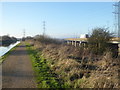
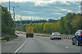
39 photos from this area
Area Information
Key information about the B71 3QQ including its size, population, and administrative classification.
- Area Type
- Postcode
- Area Size
- 1.4 hectares
- Population
- 1494
- Population Density
- 5003 people/km²
House Prices in B71 3QQ
42
Properties
£129,093
Average Sold Price
£20,875
Lowest Price
£306,500
Highest Price
Showing 42 properties
| Address | Type | Beds | Baths | Last Sale Price | Last Sale Date | |
|---|---|---|---|---|---|---|
| 124 Andrew Road, West Bromwich, B71 3QQ | Bungalow | 3 | 1 | £20,875 | Aug 2024 | |
| 97 Andrew Road, West Bromwich, B71 3QQ | Semi-detached | 3 | 1 | £306,500 | Nov 2023 | |
| 140 Andrew Road, West Bromwich, B71 3QQ | house | - | - | £250,000 | Apr 2022 | |
| 65 Andrew Road, West Bromwich, B71 3QQ | house | - | - | £200,000 | Nov 2021 | |
| 128 Andrew Road, West Bromwich, B71 3QQ | Bungalow | - | - | £195,000 | Aug 2021 | |
| 98 Andrew Road, West Bromwich, B71 3QQ | Semi-detached | 4 | 1 | £185,000 | Jul 2020 | |
| 112 Andrew Road, West Bromwich, B71 3QQ | Semi-detached | 4 | 2 | £200,000 | Jan 2020 | |
| 120 Andrew Road, West Bromwich, B71 3QQ | Bungalow | 2 | - | £190,000 | Sep 2019 | |
| 108 Andrew Road, West Bromwich, B71 3QQ | Bungalow | - | - | £172,000 | May 2018 | |
| 67 Andrew Road, West Bromwich, B71 3QQ | Semi-detached | 3 | 1 | £155,000 | Oct 2017 |
Page 1 of 5
Energy Efficiency in B71 3QQ
Amenities
Schools
| Rank | School | Type | Entry gender | Ages |
|---|
Explore more schools in this area
Go to Schools tabDemographics
Household Size
Two person
most common
Accommodation Type
Houses
most common
Tenure
82
majority
Ethnic Group
White
most common
Religion
N/A
most common
Household Composition
N/A
most common
Age
47
median
Adults (30-64 years)
most common
Household Deprivation
N/A
with no deprivation
NS-SEC
26
in Lower managerial occupations
Explore more demographic insights in this area
Go to Demographics tabPlanning
Planning Constraints
- Flood RiskPremium
- Ramsar Wetland SitesPremium
- Area of Outstanding Natural BeautyPremium
- Protected Nature ReservePremium
- Protected WoodlandPremium