Area Overview for B71 3PY
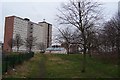
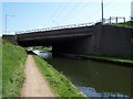
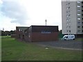
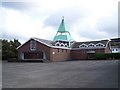
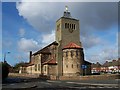
Photos of B71 3PY


Area Information
Charlemont with Grove Vale forms a significant residential ward within the Metropolitan Borough of Sandwell, sitting in the West Midlands region. This postcode, B71 3PY, marks a specific residential cluster with a population of 1,494 people. The area encompasses distinct neighbourhoods including Charlemont Farm, Bustleholme Mill, Church Vale, Bird End, and the historic site of Grove Vale. Historically, the landscape featured Charlemont Hall before the 1940s and Wigmore School until its demolition in 2002. Today, residents navigate places that have evolved from traditional settlements into modern communities. The coordinates 52.542°N 1.964°W place it firmly within the West Bromwich East parliamentary constituency. Living in B71 3PY means residing in a region where the past meets the present. You will find yourself close to established landmarks like the gatehouse at the former Wigmore School site. The ward contains part of the Sandwell Valley, offering a setting that blends historical depth with contemporary residential needs.
- Area Type
- Postcode
- Area Size
- Not available
- Population
- 1494
- Population Density
- 5003 people/km²
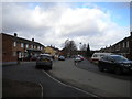
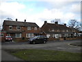
B71 3PY is fundamentally an owner-occupied market rather than a rental hub. With 82% of residents owning their homes, the primary housing stock consists of houses. This high rate of ownership suggests a community built on tenure stability rather than short-term tenancies. You will find that most properties have been maintained through generations of ownership. The presence of houses as the main accommodation type aligns with the age profile of the residents. Buyers looking for a foothold in this cluster can expect to join a group of neighbours who have invested in their local properties. This structure supports a property market where value often grows through individual upkeep and community stability. The dominance of freehold homes means decisions on renovations or modifications typically remain within the control of the occupants.
House Prices in B71 3PY
No properties found in this postcode.
Energy Efficiency in B71 3PY
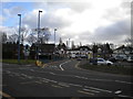
Daily life in B71 3PY benefits from a practical range of amenities just outside the immediate residential cluster. You can easily reach Tame Bridge Parkway Railway Station and Hamstead Railway Station for rail travel needs. Rail options include five nearby stations, giving you flexibility in commuting routes. For shopping, Tesco Sandwell offers a comprehensive retail experience, while Morrisons Daily provides essential provisions. These five retail outlets ensure you do not need to travel far for groceries or household goods. Beyond shopping, three major transport hubs, including Black Lake and Wednesbury Great Western Street, surround the area. Finding homes in B71 3PY places you near a mix of utilities essential for a comfortable lifestyle. The availability of these specific venues means you have convenient access to daily necessities without excessive travel time.
Amenities
Schools
| Rank | School | Type | Entry gender | Ages |
|---|
Explore more schools in this area
Go to Schools tabDemographics
The community in this postcode reflects a mature population. The median age is 47, and adults between 30 and 64 years represent the most common age range. About 82% of dwellers are homeowners, indicating a stable, settled neighbourhood where families have put down roots. The predominant ethnic group is White, which shapes the cultural makeup of the local shops and social groups. Accommodation consists primarily of houses rather than flats or high-rise apartments. This profile suggests a family-oriented environment where long-term residents.value stability. Higher home ownership rates often correlate with lower transient populations, creating a predictable environment for children and older residents alike. The demographic data points to a neighbourhood where residents have likely lived for many years, fostering established social networks and local traditions.
Household Size
Accommodation Type
Tenure
Ethnic Group
Religion
Household Composition
Age
Household Deprivation
NS-SEC
Explore more demographic insights in this area
Go to Demographics tabPlanning
Planning Constraints
- Flood RiskPremium
- Ramsar Wetland SitesPremium
- Area of Outstanding Natural BeautyPremium
- Protected Nature ReservePremium
- Protected WoodlandPremium