Area Overview for B71 3LZ
Photos of B71 3LZ


Area Information
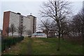
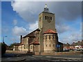
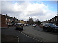
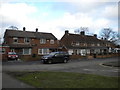
B71 3LZ is a small residential postcode area in England, situated within the historically significant Hateley Heath ward of West Bromwich, Sandwell. With a population of 1,772, it reflects a compact, tightly knit community shaped by post-war council housing developments. The area’s character is rooted in its 1930s and 1950s origins, when private and public builders constructed homes that still define the neighbourhood today. While it faced challenges in the late 20th century, including high unemployment and crime, recent efforts have focused on improving safety, reducing anti-social behaviour, and enhancing green spaces. Living here means navigating a mix of older housing stock and newer private developments, with a strong local identity. The area’s proximity to retail, transport, and educational facilities makes it practical for families and commuters. Its modest size means that daily life is closely connected to nearby amenities, from schools to rail stations, creating a self-contained yet dynamic environment for residents.
- Area Type
- Postcode
- Area Size
- Not available
- Population
- 1772
- Population Density
- 3842 people/km²
The property market in B71 3LZ is characterised by a 50% home ownership rate, meaning half of the housing stock is owner-occupied, with the remainder likely rented out. The accommodation type is primarily houses, which is unusual for areas with high population density but reflects the post-war council housing legacy. This mix of older and newer homes suggests a modest but stable market, with limited scope for large-scale redevelopment. For buyers, the area’s small size means competition for properties is likely to be localised, with limited options beyond immediate surroundings. The predominance of houses may appeal to families seeking space, though the lack of high-end listings indicates a more practical, value-focused market. Prospective buyers should consider the age of properties and the need for maintenance, as many homes date back to the 1950s.
House Prices in B71 3LZ
No properties found in this postcode.
Energy Efficiency in B71 3LZ
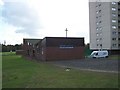
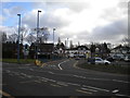
Daily life in B71 3LZ is shaped by its accessible amenities, which include retail, transport, and community hubs. The area’s five retail outlets, such as Tesco Sandwell and Morrisons Daily, cater to everyday needs, while nearby rail and metro stations provide swift access to broader networks. Parks and open spaces are not explicitly detailed in the data, but the area’s focus on greener environments suggests some local greenery. The presence of schools, community centres, and transport links fosters a sense of convenience, allowing residents to balance work, education, and leisure. While the area lacks high-end dining or entertainment venues, its practicality and proximity to larger cities make it a viable choice for those prioritising functionality over luxury. The mix of retail and transport options ensures that daily routines are efficient, even in a small postcode area.
Amenities
Schools
Residents of B71 3LZ have access to a range of educational institutions, including primary schools and specialist provision. Hall Green Primary School, rated ‘good’ by Ofsted, serves the area alongside Hall Green Junior and Infant Schools, which were merged in 1999. These primary schools provide a foundation for younger children, while The Bridge Centre (KS4 Unit) offers further education opportunities. Millfield School, a special needs institution, ensures support for students with specific requirements. The variety of school types reflects a commitment to catering for diverse educational needs, from early years through to post-16 learning. Families seeking a comprehensive education system will find the proximity of these schools convenient, though the absence of secondary schools within the postcode may require commuting to nearby areas.
| Rank | School | Type | Entry gender | Ages |
|---|
Explore more schools in this area
Go to Schools tabDemographics
The population of B71 3LZ has a median age of 47, with the majority of residents falling within the 30-64 age range. This suggests a community dominated by working-age adults, many of whom are likely to be raising families or in established careers. Home ownership stands at 50%, indicating a balanced mix of owner-occupied properties and rental homes. The accommodation type is predominantly houses, reflecting a residential area with larger, more traditional housing stock. The predominant ethnic group is White, aligning with broader demographic trends in the West Midlands. While specific data on deprivation is not provided, the area’s history of social challenges in the 1980s and 1990s suggests that ongoing investment in community projects and infrastructure is critical to maintaining quality of life. The presence of schools and amenities within walking distance supports a family-oriented environment.
Household Size
Accommodation Type
Tenure
Ethnic Group
Religion
Household Composition
Age
Household Deprivation
NS-SEC
Explore more demographic insights in this area
Go to Demographics tabPlanning
Planning Constraints
- Flood RiskPremium
- Ramsar Wetland SitesPremium
- Area of Outstanding Natural BeautyPremium
- Protected Nature ReservePremium
- Protected WoodlandPremium