Area Overview for B71 3LB
Photos of B71 3LB
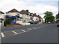
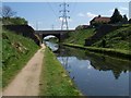
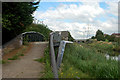
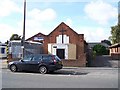

17 photos from this area
Area Information
Key information about the B71 3LB including its size, population, and administrative classification.
- Area Type
- Postcode
- Area Size
- 9839 m²
- Population
- 1772
- Population Density
- 3842 people/km²
House Prices in B71 3LB
15
Properties
£247,062
Average Sold Price
£59,000
Lowest Price
£362,500
Highest Price
Showing 15 properties
| Address | Type | Beds | Baths | Last Sale Price | Last Sale Date | |
|---|---|---|---|---|---|---|
| 84 Hall Green Road, West Bromwich, B71 3LB | Semi-detached | 3 | - | £130,000 | Dec 2025 | |
| 78 Hall Green Road, West Bromwich, B71 3LB | house | - | - | £362,500 | Dec 2024 | |
| 76 Hall Green Road, West Bromwich, B71 3LB | house | - | - | £334,995 | Dec 2024 | |
| 86 Hall Green Road, West Bromwich, B71 3LB | house | - | - | £305,000 | Nov 2023 | |
| Doves Cottage, 88 Hall Green Road, West Bromwich, B71 3LB | Bungalow | - | - | £275,000 | Apr 2021 | |
| 94 Hall Green Road, West Bromwich, B71 3LB | house | - | - | £265,000 | Dec 2020 | |
| 102 Hall Green Road, West Bromwich, B71 3LB | Semi-detached | 3 | 1 | £245,000 | Apr 2008 | |
| 82 Hall Green Road, West Bromwich, B71 3LB | Detached | - | - | £59,000 | Apr 1996 | |
| 130 Hall Green Road, West Bromwich, B71 3LB | Flat | - | - | - | - | |
| 128D Hall Green Road, West Bromwich, B71 3LB | Flat | - | - | - | - |
Page 1 of 2
Energy Efficiency in B71 3LB
Amenities
Schools
| Rank | School | Type | Entry gender | Ages |
|---|
Explore more schools in this area
Go to Schools tabDemographics
Household Size
Family (3-5 people)
most common
Accommodation Type
Houses
most common
Tenure
50
majority
Ethnic Group
White
most common
Religion
N/A
most common
Household Composition
N/A
most common
Age
47
median
Adults (30-64 years)
most common
Household Deprivation
N/A
with no deprivation
NS-SEC
17
in Lower managerial occupations
Explore more demographic insights in this area
Go to Demographics tabPlanning
Planning Constraints
- Flood RiskPremium
- Ramsar Wetland SitesPremium
- Area of Outstanding Natural BeautyPremium
- Protected Nature ReservePremium
- Protected WoodlandPremium