Area Overview for B71 2SD
Photos of B71 2SD
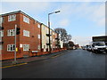
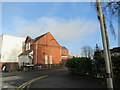
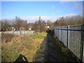
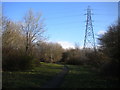
27 photos from this area
Area Information
Key information about the B71 2SD including its size, population, and administrative classification.
- Area Type
- Postcode
- Area Size
- 2.2 hectares
- Population
- 2171
- Population Density
- 3974 people/km²
House Prices in B71 2SD
26
Properties
£126,375
Average Sold Price
£45,000
Lowest Price
£200,000
Highest Price
Showing 26 properties
| Address | Type | Beds | Baths | Last Sale Price | Last Sale Date | |
|---|---|---|---|---|---|---|
| 4 Ely Crescent, West Bromwich, B71 2SD | house | - | - | £168,000 | Dec 2021 | |
| 19 Ely Crescent, West Bromwich, B71 2SD | house | - | - | £178,000 | Aug 2021 | |
| 15 Ely Crescent, West Bromwich, B71 2SD | house | - | - | £181,000 | Mar 2021 | |
| 24 Ely Crescent, West Bromwich, B71 2SD | house | - | - | £165,000 | Dec 2020 | |
| 13 Ely Crescent, West Bromwich, B71 2SD | Semi-detached | 3 | 2 | £200,000 | Aug 2020 | |
| 7 Ely Crescent, West Bromwich, B71 2SD | house | - | - | £104,000 | Jun 2016 | |
| 26 Ely Crescent, West Bromwich, B71 2SD | Terraced | 3 | - | £105,000 | Jun 2014 | |
| 18 Ely Crescent, West Bromwich, B71 2SD | Semi-detached | - | - | £100,000 | Mar 2010 | |
| 23 Ely Crescent, West Bromwich, B71 2SD | house | - | - | £115,000 | Dec 2009 | |
| 2 Ely Crescent, West Bromwich, B71 2SD | Terraced | - | - | £108,500 | Nov 2005 |
Page 1 of 3
Energy Efficiency in B71 2SD
Amenities
Schools
| Rank | School | Type | Entry gender | Ages |
|---|
Explore more schools in this area
Go to Schools tabDemographics
Household Size
Family (3-5 people)
most common
Accommodation Type
Houses
most common
Tenure
48
majority
Ethnic Group
White
most common
Religion
N/A
most common
Household Composition
N/A
most common
Age
47
median
Adults (30-64 years)
most common
Household Deprivation
N/A
with no deprivation
NS-SEC
14
in Lower managerial occupations
Explore more demographic insights in this area
Go to Demographics tabPlanning
Planning Constraints
- Flood RiskPremium
- Ramsar Wetland SitesPremium
- Area of Outstanding Natural BeautyPremium
- Protected Nature ReservePremium
- Protected WoodlandPremium