Area Overview for B71 2RS
Photos of B71 2RS
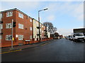
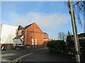
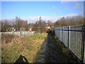
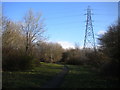
27 photos from this area
Area Information
Key information about the B71 2RS including its size, population, and administrative classification.
- Area Type
- Postcode
- Area Size
- 1.6 hectares
- Population
- 2171
- Population Density
- 3974 people/km²
House Prices in B71 2RS
46
Properties
£123,314
Average Sold Price
£35,000
Lowest Price
£218,000
Highest Price
Showing 46 properties
| Address | Type | Beds | Baths | Last Sale Price | Last Sale Date | |
|---|---|---|---|---|---|---|
| 19 Bedford Road, West Bromwich, B71 2RS | Semi-detached | 3 | 2 | £218,000 | Nov 2024 | |
| 40 Bedford Road, West Bromwich, B71 2RS | Terraced | 2 | 1 | £215,000 | Mar 2023 | |
| 37 Bedford Road, West Bromwich, B71 2RS | Bungalow | 2 | 1 | £168,000 | Aug 2018 | |
| 35 Bedford Road, West Bromwich, B71 2RS | Bungalow | - | - | £138,000 | Mar 2017 | |
| 43 Bedford Road, West Bromwich, B71 2RS | Semi-detached | 4 | - | £120,000 | Aug 2016 | |
| 24 Bedford Road, West Bromwich, B71 2RS | house | - | - | £128,200 | Sep 2015 | |
| 39 Bedford Road, West Bromwich, B71 2RS | Bungalow | 2 | 1 | £107,000 | Aug 2015 | |
| 44 Bedford Road, West Bromwich, B71 2RS | Semi-detached | 3 | - | £123,000 | Mar 2015 | |
| 2 Bedford Road, West Bromwich, B71 2RS | house | - | - | £80,000 | Nov 2013 | |
| 17 Bedford Road, West Bromwich, B71 2RS | house | 3 | 1 | £80,000 | Apr 2011 |
Page 1 of 5
Energy Efficiency in B71 2RS
Amenities
Schools
| Rank | School | Type | Entry gender | Ages |
|---|
Explore more schools in this area
Go to Schools tabDemographics
Household Size
Family (3-5 people)
most common
Accommodation Type
Houses
most common
Tenure
48
majority
Ethnic Group
White
most common
Religion
N/A
most common
Household Composition
N/A
most common
Age
47
median
Adults (30-64 years)
most common
Household Deprivation
N/A
with no deprivation
NS-SEC
14
in Lower managerial occupations
Explore more demographic insights in this area
Go to Demographics tabPlanning
Planning Constraints
- Flood RiskPremium
- Ramsar Wetland SitesPremium
- Area of Outstanding Natural BeautyPremium
- Protected Nature ReservePremium
- Protected WoodlandPremium