Area Overview for B71 2RE
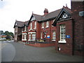
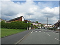
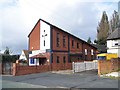
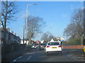
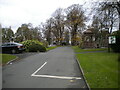
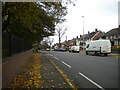
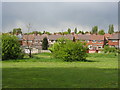
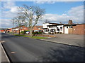
Photos of B71 2RE


Area Information
Living in B71 2RE means inhabiting a compact residential cluster in West Bromwich, part of Sandwell in the West Midlands. With a population of 1,622, the area is defined by post-war council housing, reflecting its origins in the 1930s and 1950s. This small postcode area is part of the Hateley Heath ward, a historically working-class community that saw significant redevelopment in the 2010s. Daily life here is shaped by its urban layout, with a focus on practicality over luxury. The area’s proximity to major transport routes and retail hubs makes it accessible for commuters, while its history of social challenges—like high unemployment in the 1990s—has given way to recent community-led improvements. Residents benefit from nearby amenities, including schools and parks, though the character of the area remains rooted in its mid-20th-century housing stock. For those seeking a no-frills, family-oriented environment with a strong sense of local identity, B71 2RE offers a distinct blend of affordability and proximity to essential services.
- Area Type
- Postcode
- Area Size
- Not available
- Population
- 1622
- Population Density
- 4505 people/km²
B71 2RE’s property market is characterised by a 63% home ownership rate, with houses making up the majority of the accommodation stock. This suggests a mix of owner-occupied properties and rental units, though the small size of the area means the housing stock is limited. The prevalence of houses, likely semi-detached or terraced, reflects its origins as a mid-20th-century council housing estate. Buyers in this area should expect a modest selection of properties, with little scope for large-scale development. The market is likely to appeal to those seeking affordable, practical housing in a compact urban setting. However, the area’s history of redevelopment in the 2010s may have introduced newer properties, offering a blend of traditional and modern options. For first-time buyers, the limited supply could mean competition, but the proximity to transport and amenities may offset this.
House Prices in B71 2RE
No properties found in this postcode.
Energy Efficiency in B71 2RE
Life in B71 2RE is shaped by its proximity to essential amenities. Retail options include Co-op Hill, Morrisons Daily, and Tesco Sandwell, offering everyday shopping convenience. The area’s transport network is robust, with five metro stops and five rail stations providing access to nearby hubs. For leisure, the nearby Bromwich Hall – Manor House Museum, a medieval timber-framed building, offers a historical attraction. While parks and green spaces are not explicitly mentioned, the area’s focus on community projects suggests efforts to improve public spaces. The presence of former schools like Hateley Heath Infant and Junior Schools, though closed, indicates a legacy of education. Overall, the area balances practicality with accessibility, making it suitable for those prioritising convenience over luxury.
Amenities
Schools
| Rank | School | Type | Entry gender | Ages |
|---|
Explore more schools in this area
Go to Schools tabDemographics
The population of B71 2RE is 1,622, with a median age of 47, indicating a mature community. The most common age range is adults aged 30–64, suggesting a stable, working-age population. Home ownership stands at 63%, with the predominant accommodation type being houses, likely semi-detached or terraced properties. The area’s demographic profile is largely White, reflecting its historical roots in post-war housing developments. While specific data on deprivation is not provided, the area’s history of high unemployment in the 1990s implies that economic challenges may have shaped its social fabric. However, recent investments in community projects and housing suggest improvements in quality of life. The age profile and home ownership rate indicate a community focused on long-term stability, with a mix of older residents and families.
Household Size
Accommodation Type
Tenure
Ethnic Group
Religion
Household Composition
Age
Household Deprivation
NS-SEC
Explore more demographic insights in this area
Go to Demographics tabPlanning
Planning Constraints
- Flood RiskPremium
- Ramsar Wetland SitesPremium
- Area of Outstanding Natural BeautyPremium
- Protected Nature ReservePremium
- Protected WoodlandPremium